Dynon Avionics SkyView Pilots Users Guide User Manual
Page 154
SV-MAP-270 Navigation Mapping Software
7-64
SkyView Pilot’s User Guide - Revision S
Vertical Speed Required to Destination shows the vertical speed
necessary to descend from the current position and altitude to a defined
target position and altitude above and before your final waypoint at the
current ground speed. This information is also displayed as a magenta
line on the vertical speed indicator.
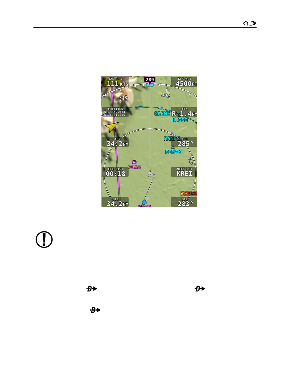
Figure 140 - Map Info Items
Touch-enabled Info Items
You can place any of the following menu shortcuts in the info block space on the Moving
Map. Tapping on any of the shortcut buttons will result in the same action as pressing
the corresponding menu button, regardless of what menu is currently displayed.
o Direct-To: When an airport, navaid, or other waypoint is selected on the map
tap the
button brings up the Info page on it. Tap
again to instantly
start navigation to an airport, navaid, or other waypoint selected in the Info,
Nearest, Flight Plan, or Map Pointer pages. If there is an active flight plan,
touching
and the current waypoint will appear on the resulting info page.
o FPL Page: Tap FPL (Flight Plan) to bring up a window that can be used to create,
display, or modify the SkyView Flight Plan.
These Info Items are only available on an SV-D1000T display. Additionally, the top
left and top right info item boxes cannot be set as TOUCH items.