Dynon Avionics SkyView Pilots Users Guide User Manual
Page 113
SV-MAP-270 Navigation Mapping Software
SkyView Pilot’s User Guide - Revision S
7-23
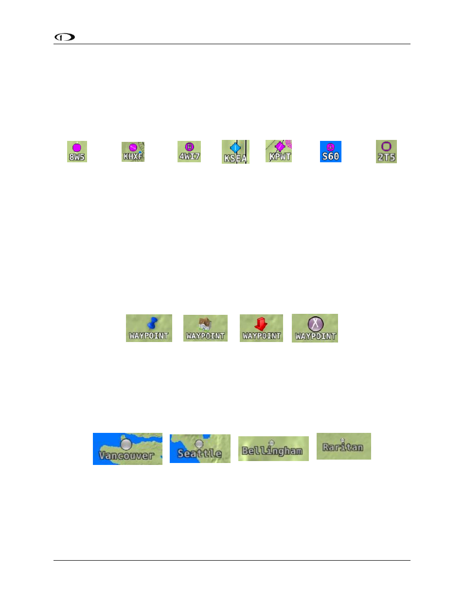
Airports
SkyView represents an airport with a circle and a text name. If more information is provided in
the database, a modifier may be added to the icon. A line in the circle represents the direction
of the primary runway. Other symbology may be used in the circle such as an “R” to denote a
private airport, an anchor to denote a seaplane base, or a ring to denote a military airport.
Airport
Airport
(primary
runway
direction
indicated)
Private
Airport
Airport
With
Control
Tower
(blue)
Airport
with
services
(ticks at
edges)
Seaplane
Base
Public
Airport (no
hard
surface
runway)
Figure 95–Moving Map Airport Example Icons
User Waypoints
SkyView supports a diverse set of icons that can be used to identify User Waypoints. A few of
the many available icons are shown here. See the SkyView User Waypoints section below for
detailed information on editing user waypoints.
Table 7 - User Waypoint Icon Examples
Cities
SkyView displays cities and towns on the map. Their prominence on the map is determined by
population.
“Mega” City
Large Place
Medium Place
Small Place
Table 8 - Places on Moving Map