Dynon Avionics SkyView Pilots Users Guide User Manual
Page 120
SV-MAP-270 Navigation Mapping Software
7-30
SkyView Pilot’s User Guide - Revision S
considers a target a threat if the device providing traffic reports that it is a threat. The TIS
system considers a target to be a threat if it is calculated to be within 1/4 mile of your aircraft at
its closest approach within 30 seconds (20 seconds if the target is not reporting altitude). Other
traffic devices may have different criteria for reporting traffic as threats. Refer to their
documentation for more information.
If a target is a Traffic Advisory but cannot be displayed on the screen because its location is
beyond the edge of the map at its current range (zoom) level, it will appear at the edge of the
Map Page, half shaded as seen in Figure 102 above (the darkly shaded area of the Traffic
Advisory Symbol will always point towards the edge of the screen). This ensures that you are
aware of the threat regardless of map range level. Note that the orange vector arrow may not
be visible when a Traffic Advisory is off the screen.
Proximity Advisory Targets
Figure 103 - Proximity Advisory
Proximity have less of a chance of being a factor based on their position, but are not a Traffic
Advisory because they are not converging with your aircraft within the next 30 seconds. A
Proximity Advisory symbol is shown on the map when it is closer than 5 nm and within +/- 1200
ft. of your altitude, but doesn’t meet the criteria to trigger a Traffic Advisory.
Non-Threat Targets
Figure 104 - Non-Threat
Non-threat Targets are any other detectable aircraft that are neither Traffic Advisory Targets
nor Proximity Advisory Targets.
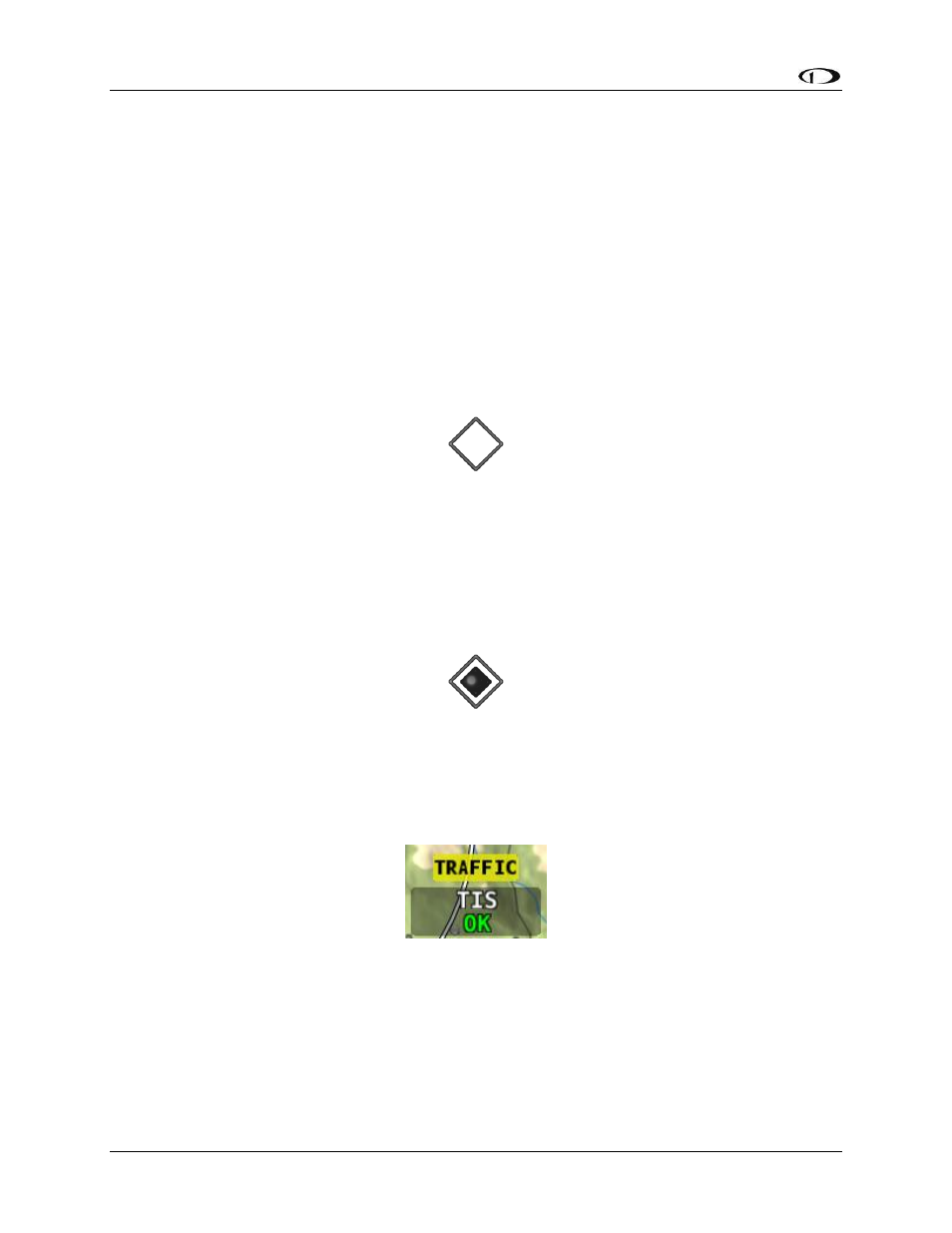
Traffic Receiver Status
Figure 105 - Traffic Status
A widget in the lower right area of the Map Page annunciates both the device that is currently
providing traffic and the status of the traffic receiver.
Possible devices and their possible states include:
ADS-B: Any ADS-B source – such as the SV-ADSB-470.