Navigation and flight planning -35 – Dynon Avionics SkyView Pilots Users Guide User Manual
Page 125
SV-MAP-270 Navigation Mapping Software
SkyView Pilot’s User Guide - Revision S
7-35
Navigation and Flight Planning
SkyView’s Navigation Mapping Software course information can be displayed on
the SkyView PFD’s HSI display when it is selected and navigating to an active
waypoint. It is always labeled SKYVIEW in the HSI and in the Flight Planning
window.
Navigation Methods
SkyView supports two internal types of navigation. Direct-To navigation lets you quickly fly
“directly to” a waypoint by pushing the
button whenever it is displayed. Additionally,
SkyView offers robust Flight Planning that allows navigation to a sequence of one or more
waypoints. Both of these methods are covered in the following sections.
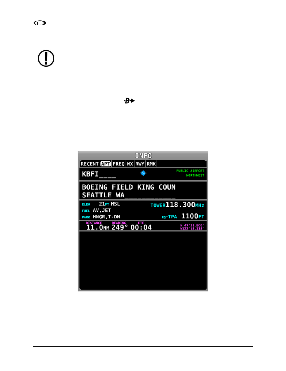
Find an Airport or Navaid by Identifier
To find an airport or navaid, press MAP > INFO. A window like the one seen in Figure 108 will
be displayed.
Figure 108–Moving Map Info Window
When the Info window is first displayed it shows detailed information about the airport or
navaid that was most recently used or selected. From here, you can move the CURSR joystick
down to find the desired item by identifier, facility, or city*. To do this, move the CURSR joystick
up/down to move between identifier (top), facility name (middle), and city* (bottom) fields;