Dynon Avionics SkyView Pilots Users Guide User Manual
Page 102
SV-MAP-270 Navigation Mapping Software
7-12
SkyView Pilot’s User Guide - Revision S
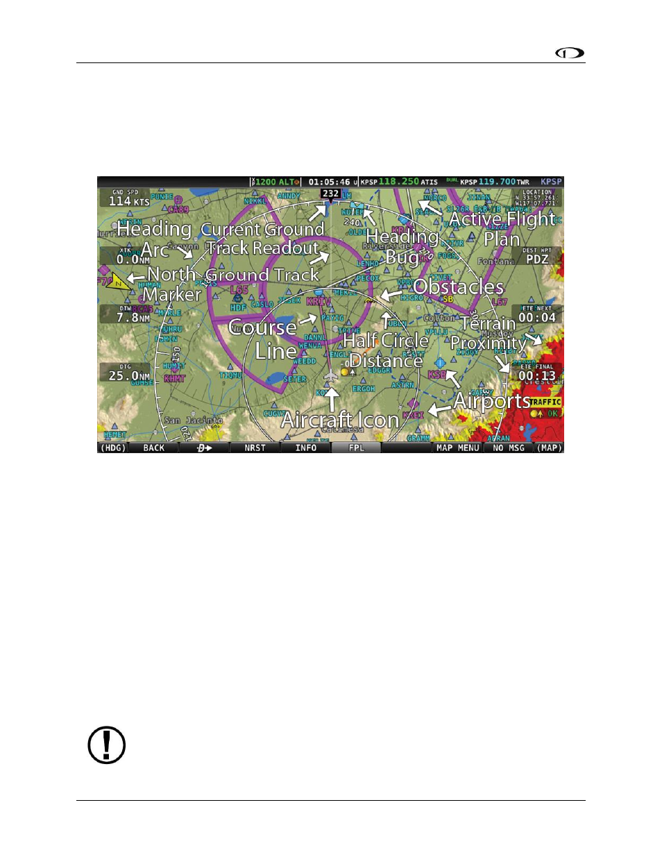
Moving Map Page Layout
The Moving Map Page as shown in Figure 75 displays a real-time topographical map in Track Up
or North Up mode (depending on user setting). The map is sourced from a database that is
stored inside the display and correlated to your current position using a GPS feed.
Figure 75–SkyView Moving Map
The following items are displayed on the Moving Map Page shown in Figure 75:
Topography (terrain and bodies of water) with Terrain Proximity Alerting
Default Aircraft Icon with Ground Track Line
Distance Circle and Range
Heading Arc, Current Ground Track, Heading Bug, True North Marker
Configurable Info Items. Examples include GPS Ground Speed (SPEED), GPS Altitude
(ALTITUDE), Distance to Waypoint (DTW), and Bearing to Waypoint (BTW).
Course line (only displayed when actively navigating to an aviation waypoint)
Airports with runways (if known)
Obstacles
Airspace (with floors/ceilings)
Navigation aids, such as VORs, NDBs, and Fixes
Active Flight Plan
SkyView uses a map projection that does not distort distance. This means that the
courses - which are the ideal “great circle” routes - appear as straight lines on the
screen.