Triton TargetPro User Manual
Page 55
June 2004 TargetPro™ User's Manual
TargetPro’s geocorrecting function can compensate for this distortion in contact
(CON) or target (TGT) files by adjusting the image. In addition, if you conducted
your data survey in a direction other than a northerly heading, you can force the
orientation of your contact to display in a northerly orientation, in keeping with the
convention of “north points up” for displaying charts and maps. (Of course, if you
reorient your image to point north, and your tracking vessel wasn’t heading north
during the survey, your imaginary along-track path no longer points north in the
geocorrected image — it now coincides with the line of travel taken during the
survey.) Any such changes you apply to a contact or target file are saved and
displayed as a TIFF file; the original CON or TGT file is not modified.
Using the tools described in ‘Measuring a Contact Image’, you can measure the
width and length of a geocorrected image.
To geocorrect a CON or TGT file, do the following:
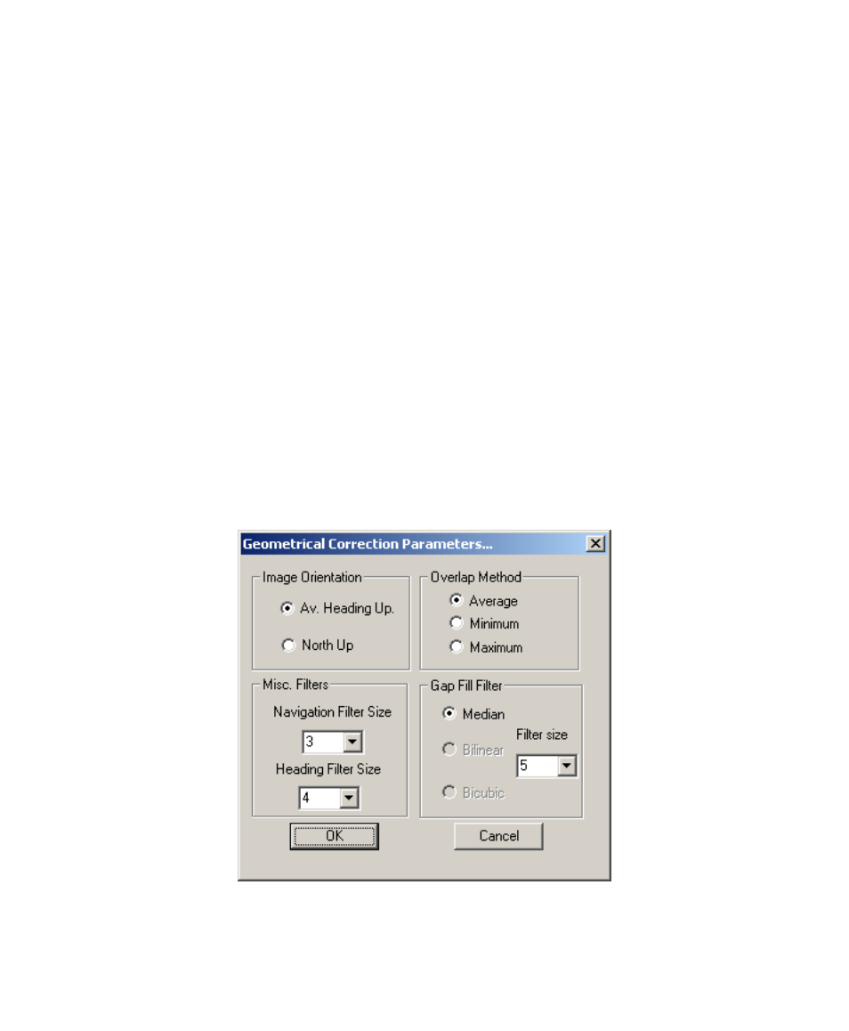
1. From the main menu, choose Tools
→Geocorrect. The system
displays the Geometrical Correction Parameters dialog box (Figure
22).
2. In the Geometrical Correction Parameters dialog box set your image
Orientation, your Overlap Method, the Filter size for a Median Gap
Fill Filter, and values for Navigation Filter Size and Heading Filter
Size.
Chapter 4: Object Modification and Classification
44