Juniper Systems LandMark Mobile User Manual
Page 72
7 LandMark Mobile User’s Manual
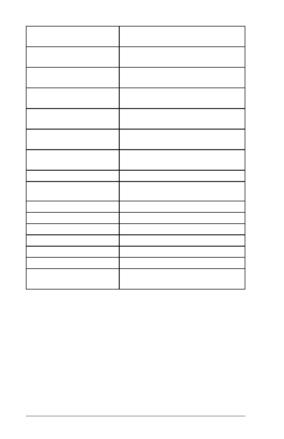
int &maskilon,
Integer part of the longitude for
Degree minute
double &maskmin_lat,
The minute part of the Degree
Minute
double &maskmin_lon,
The minute part of the Degree
Minute
int &maskiminlat,
The minute part of the Degree
Minute Second
int &maskiminlon,
The minute part of the Degree
Minute Second
double &masksec_lat,
The seconds part of the Degree
Minute Second
double &masksec_lon,
The seconds part of the Degree
Minute Second
char mask_UTMZone[]
The UTM Zone
int arr_size,
The length of the UTM Zone array
double &mask_northing
UTM northing
double &mask_easting
UTM easting
double &mask_pdop,
PDOP reading
double &mask_ehe,
EHE reading
double &mask_ehe_ft,
EHE reading in feet
int &mask-quality,
Quality reading
short &mask_msg);
If GPS was filtered, this indicates
the reason.
Mark GPS — Pulled
The mark function relies on the mark waypoint data generated by
LandMark Mobile. The GPS point is pulled after marking a point
in LandMark Mobile and using the Export button on the Mark
Point screen.
If this function is called before marking a point, it returns with
an error. The data obtained from these functions is the same as
the data exchange file. The pulled version returns immediately
with the requested data.