Juniper Systems LandMark Mobile User Manual
Page 43
LandMark Mobile User’s Manual 4
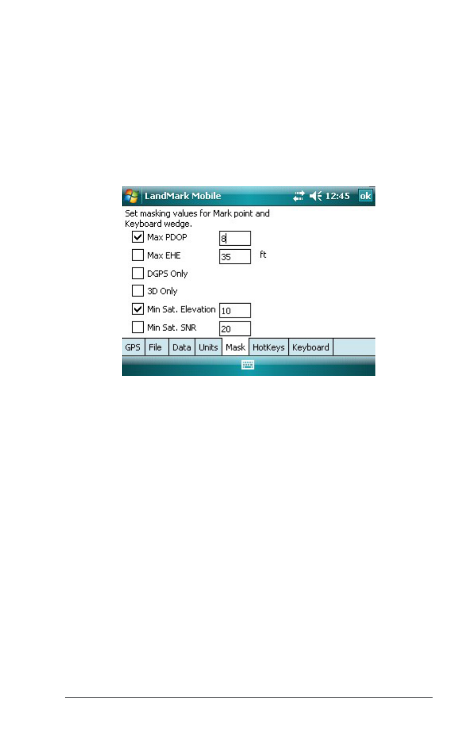
Mask Tab
The Mask tab is used to set the GPS signal masking parameters
while marking waypoints. Only those GPS fixes that meet the
specified criteria are used in averaging a waypoint. In essence,
inaccurate GPS positions are screened with this feature.
The check boxes are used to enable or disable specific masking
features. The edit boxes on the right of the check boxes are used
to specify the mask value.
Max PDOP
Select the Max PDOP (Maximum Position Dilution of Precision)
option and then enter a value in the box to the right. This
selection masks GPS PDOP readings greater than the value
entered. Only computed waypoints with a PDOP equal to or less
than the value you entered are used.
Max EHE
Select the Max EHE (Maximum Estimated Horizontal Error)
option and then enter a value in the box to the right. This masks
GPS EHE readings greater than what you enter. Only computed
waypoints with an EHE equal to or less than the value entered
are used.
DGPS Only
Select the DGPS Only option to collect GPS fixes with differential
corrections. When selected, all other points that are not DGPS are
masked.
3D Only
Select 3D Only to collect waypoints that are received when using
at least four satellites.