Route data report – Seiwa Starfish 2nd Edition User Manual
Page 62
64
User Manual
ROUTE DATA REPORT
When the Navigation to the External Route is received, it will be possible to display
the information related to the External Route by entering the Route Data Report.
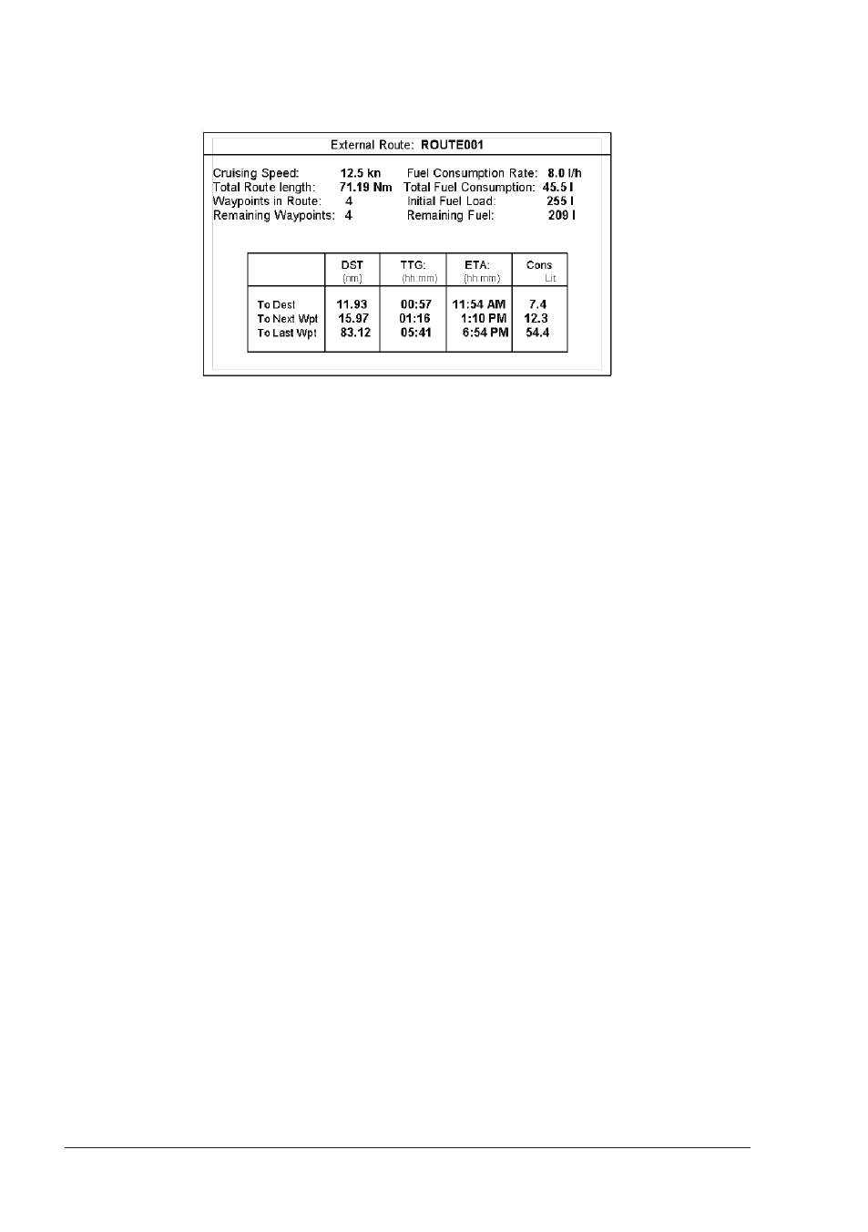
Fig. 4.4a - External route on Route Data Report
♦
External Route
: Name of the External Route (from
$PCMPN,0)
♦
Cruising Speed
: Planned Cruising Speed (from $PCMPN,1)
♦
Total Route length
: Length from First to Last Wpt (from
$PCMPN,1)
♦
Waypoints in Route
: No. of Wpts in the Route (from $PCMPN,1)
♦
Remaining Waypoints
: No. of Wpts from Dest to Last Wpt (from
$PCMPN,1)
♦
Fuel Consumption Rate
: Planned Fuel Consumption Rate (from
$PCMPN,1)
♦
Total Fuel Consumption
: Calculated Fuel consumption to navigate
the whole Route
♦
Initial Fuel Load
: Volume of Fuel available before the
navigation was started (Liters)
♦
Remaining Fuel
: Volume of Fuel available (Liters)
♦
Distance to Destination
: Distance from Ship to Destination
(calculated)
♦
Distance to Next Wpt
: Distance to travel from ship to the Wpt
after the Destination (calculated: Distance
to Dest + Next Route Leg length)
♦
Distance to Last Wpt
: Distance to travel from ship to the End of
the Route (calculated: Distance to Dest
+Distance From Dest to last Wpt received
from $PCMPN,1)
♦
TTG To Destination
: Estimated Time to travel the “Distance to
Last Wpt” (calculated using Cruising
Speed)
♦
TTG To Next Wpt
: Estimated Time to travel the “Distance to
Next Waypoint” (calculated using Cruising
Speed)
♦
TTG to Last Wpt
: Estimated Time to travel the “Distance to
Last Wpt” (calculated using Cruising
Speed)
♦
ETA to Destination
: Estimate Time of Arrival to the Destination
Point (calculated: Current Time + “TTG