Navigation, Map operation and map settings – Mercedes-Benz CLS-Class 2014 COMAND Manual User Manual
Page 115
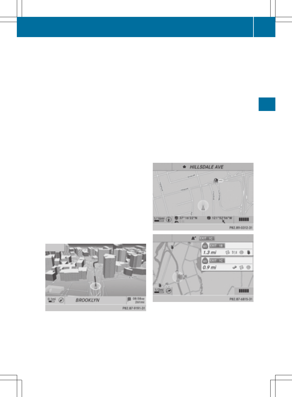
When driving on the highway, you can see the
following information on the right of the dis-
play:
R
the nearest gas stations
R
the nearest rest areas, etc.
R
and their distance from the current vehicle
position
The entries show the number of the high-
way and the highway exits as well as their
distance from the current vehicle position.
The name of the highway exit continues to
be displayed.
X
To switch to navigation mode: press the
Ø button.
X
To show the menu: press W the COMAND
controller.
X
Select
Navi
Navi
in the main function bar by
sliding ZV and turning cVd the COMAND
controller and press W to confirm.
X
Select
Map
Map Settings
Settings
and press W to con-
firm.
The map settings menu appears.
X
Select
Highway Information
Highway Information
and press
W to confirm.
Depending on the previous status, switch
the option on O or off ª.
Example: city model
Switching city view on/off
When the city model is switched on, the map
shows buildings in 3D.
X
To show the menu: press W the COMAND
controller.
X
Select
Navi
Navi
in the main function bar by
sliding ZV and turning cVd the COMAND
controller and press W to confirm.
X
Select
Map
Map Settings
Settings
and press W to con-
firm.
The map settings menu appears.
X
Select
City
City (3D)
(3D)
and press W to confirm.
Depending on the previous status, switch
the option on O or off ª.
i
The city model is only shown for "Bird's-
eye View" or "3D Map".
It is available in the 0.05 mi and 0.1 mimap
scales.
The data required for displaying buildings
is not available for all cities.
Example: intersecting roads on city routes/high-
ways
Showing/hiding intersecting streets
If route guidance is inactive, intersecting
streets can be shown on the upper edge of
the display.
Map operation and map settings
113
Navigation
Z