Navig atio n, Map operation and map settings – Mercedes-Benz CLS-Class 2014 COMAND Manual User Manual
Page 113
X
Select
Standard Symbols
Standard Symbols
,
Personal
Personal
Symbols
Symbols
or
No Symbols
No Symbols
.
If you select
Personal Symbols
Personal Symbols
, the POI
list appears.
X
To switch the symbol display on/off:
select a POI by turning cVd the COMAND
controller and press W to confirm.
Depending on the previous state of the
symbols, they will either be shown O or
hidden ª. You can switch on the symbol
displays for more than one point of interest.
X
To switch all personal symbols on/off:
select
All
All
and press W to confirm.
Depending on the previous status of the
symbols, they will either be shown O or
hidden ª.
If the function is switched on O, the indi-
vidual POIs are grayed out and the previ-
ously selected settings remain unchanged.
If the function is switched off ª, you can
reselect the individual POIs. They show the
most recently selected settings.
i
The list shows all symbols that are con-
tained on the digital map across all coun-
tries. However, not all points of interest are
available in all countries. As a result, certain
point of interest symbols may not be dis-
played on the map, even if the symbol dis-
play is switched on.
X
To exit the menu: press the k back
button.
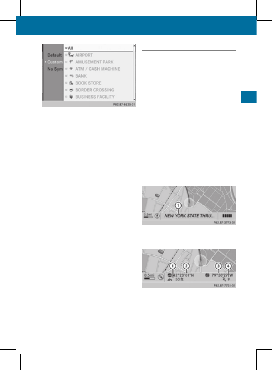
Selecting map information
Map information in the display
During route guidance, you can have map
information shown at the bottom edge of the
display.
X
To show the menu: press W the COMAND
controller.
X
Select
Navi
Navi
in the main function bar by
sliding ZV and turning cVd the COMAND
controller and press W to confirm.
X
Select
Map
Map Settings
Settings
and press W to con-
firm.
The map settings menu appears.
X
Select
Text Information On Map
Text Information On Map
and
press W to confirm.
A # dot indicates the current setting.
X
Select
Current Street
Current Street
,
Geo-coordi‐
Geo-coordi‐
nates
nates
or
None
None
and press W to confirm.
X
To exit the menu: slide XVY the COMAND
controller.
Road display
:
Road names or numbers, e.g. for high-
ways
Geo-coordinate display
:
Current height above average sea level
(rounded to the nearest 10 m)
;
Current vehicle position: latitude coordi-
nates
Map operation and map settings
111
Navig
atio
n
Z