Figure 58: coordinate projection window – NavCom SF-2040 Rev.C User Manual
Page 99
LAND-PAK™ User Guide – Rev. C
5-95
Distance is a display property only. It
does not change the format of the
data recorded to the raw file.
• Angle: Set degrees (360 degree circle,
seconds to a minute, 60 minutes to a d
or gons \ grads (a 400 unit circle fully
decimal). In other words, an angle of
397.9809 gons is equivalent to 358 d
0 min
60
egree)
egrees,
e,
imuth Setting: Select the direction for
North or South.
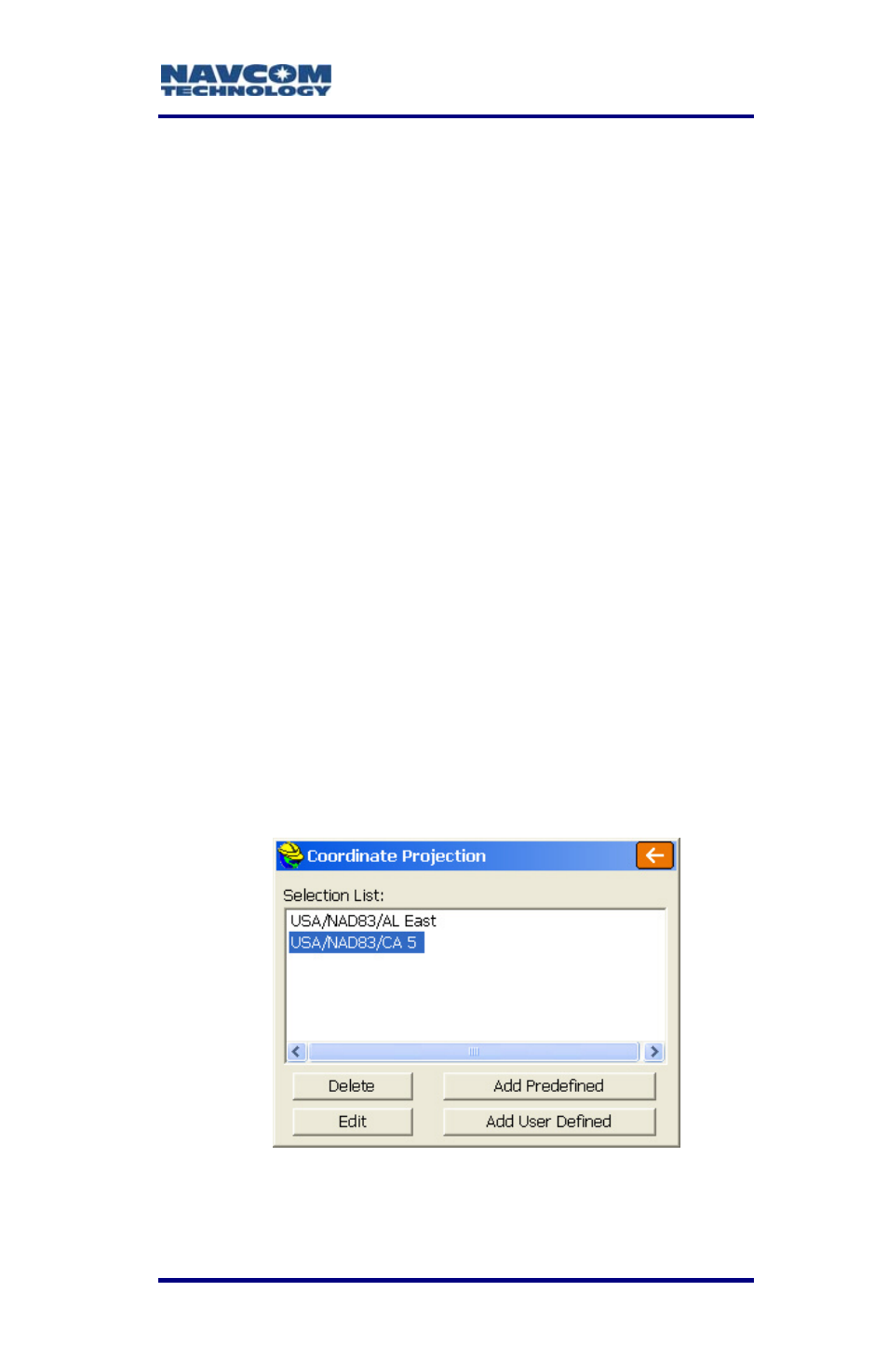
• Projection: Select a coordinate projection for
the area of the survey from the drop-down list.
If the needed projection is not in the drop-
down list, tap the Edit Projection List button.
The Coordinate Projection window opens (see
Figure 58).
1
utes and 58 seconds.
The Angle setting affects commands
where a direction is displayed or
entered, such as Inverse, Travers
Sideshot, Input-Edit Centerline.
• Zero Az
zero azimuth,
Figure 58: Coordinate Projection Window
- SF-3050 Logging Data to Internal Memory SurvCE (4 pages)
- SF-3040 Logging Data to Internal Memory or SD Card (6 pages)
- SF-3050 Logging Data to USB Using SurvCE (4 pages)
- StarFire over IP (5 pages)
- SF-3050 Quick Start (4 pages)
- SF-3050 A Computationally Efficient Ambiguity Resolution (7 pages)
- StarFire (5 pages)
- StarFire to SW v3.0.12.0 (3 pages)
- SF-3050 Rev.I (196 pages)
- StarUtil-3000 Rev.G (177 pages)
- Sapphire Rev.L (450 pages)
- StarUtil-3000 Rev.A (119 pages)
- SF-3050 Rev.A (169 pages)
- SF-3050 Rev.B (201 pages)
- SF-3050 Rev.D (235 pages)
- Rinex Utility Rev.D (17 pages)
- SF-3040 Quick Start (4 pages)
- SF-3040 Rev.F (217 pages)
- SurveCE Integration Rev.A (150 pages)
- Install Utility Rev.C (26 pages)
- LAND-PAK Quick Start Rev.B (7 pages)
- LAND-PAK Rev.E (156 pages)
- StarUtil Rev.C (58 pages)
- LAND-PAK Rev.N (194 pages)
- StarUtil Rev.B (8 pages)
- StarUtil Rev.F (134 pages)
- SF-2040 Rev.E (63 pages)
- RT-3010 Rev.E (61 pages)
- StarFire Satellite Change Rev.G (24 pages)
- StarFire Satellite Change Rev.I (23 pages)
- TS Collecting Receiver (2 pages)
- TS Factory Default (2 pages)
- LAND-PAK Rev.F (159 pages)
- SF-2040 Rev.F (93 pages)
- RT-3020 Rev.F (93 pages)
- SF-2110 Quick Start Rev.A (2 pages)
- StarPac Rev.A (15 pages)
- StarControl Rev.C (56 pages)
- SF-2050 Rev.F (99 pages)
- TruBlu Rev.A (2 pages)
- VueStar Rev.B (13 pages)
- SF-2110 Rev.B (99 pages)
- StarUtil-2110 Rev.A (85 pages)
- RT-3010 Rev.F (89 pages)