Home menu, Boom monitoring, Boom monitor – TeeJet Matrix 840G User Manual User Manual
Page 59
55
98-05188 R2
www.teejet.com
SHP
ESRI Data
Selecting to save a SHP fi le will create a GIS (Geographic
Information System) or shapefi le. Shape fi les are a useful tool as
many customers use third party GIS software to plot, store and
analyze data collected by the Matrix 570G.
"Balancing the inputs and outputs on a farm is fundamental to its
success and profi tability. The ability of GIS to analyze and visualize
agricultural environments and workfl ows has proven to be very
benefi cial to those involved in the farming industry.
From mobile GIS in the fi eld to the scientifi c analysis of production
data at the farm manager's offi ce, GIS is playing an increasing role
in agriculture production throughout the world by helping farmers
increase production, reduce costs, and manage their land more
effi ciently."
– ESRI.com
A shapefi le is a digital vector storage format for storing geometric
location and associated attribute information.
Figure 4-9: Save SHP
Figure 4-10: ESRI Data Example
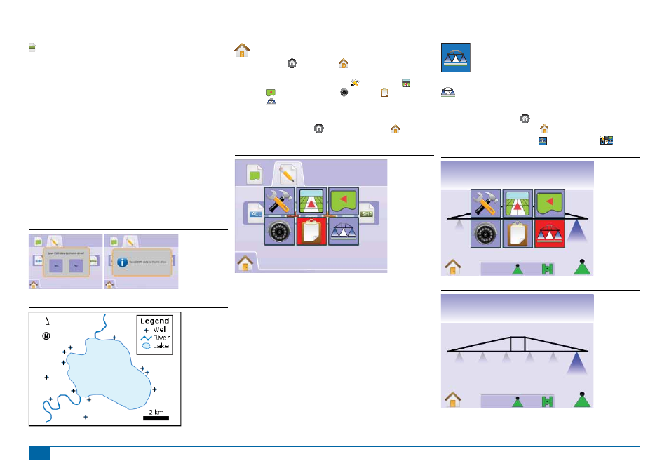
Home Menu
The Home Button or Home Icon gives you access to the
unit’s three functions: Setup, Guidance and Monitoring. The six
touch screen Menu Options (Unit Setup , Vehicle View ,
Field View , RealView Guidance , Job View and Boom
Monitoring ) quickly access all aspects of the unit.
To view the Home Menu options:
1. Press HOME BUTTON or select HOME ICON in bottom
left corner of either screen.
Figure 4-11: Home Menu
BOOM MONITORING
Boom Monitoring displays boom sections activity,
Guidance activity and Status Bar activity. BoomPilot can
be set from this screen.
Boom Monitor
To view the Boom Monitoring screen:
1. Press HOME BUTTON or press the screen to activate the
icons and select HOME ICON in bottom left corner of screen.
2. Select BOOM MONITORING from Home Menu
.
Figure 4-12: Home Menu - Boom Monitoring
Swath
ha
0.0
0
Figure 4-13: Boom Monitoring
km/h
ha
0.0
3.3