Navi gati on, Map operation and settings – Mercedes-Benz C-Coupe 2012 COMAND Manual User Manual
Page 105
While scrolling the map (
Y
page 61), you will
see the geo-coordinates of the crosshair
position. Height display : and number of
satellites used ? are not displayed.
"None" menu option
Display switched off
:
Current map orientation
i
During the "Move map" function you can
see additional information depending on
the position of the crosshair, such as a road
name, if the digital map supports this data.
Switching the topographical map on/
off
The topographical map uses different colors
to depict elevation. The color key generally
reflects the topography's dominant
vegetation or the ground's perceived color
when seen from the air, for example:
R
green (grass) for lowland
R
yellow, brown (woodland) for hills
R
gray (stone) and white (snow) for
mountains.
X
To show the menu: press W the COMAND
controller.
X
Select
Navi
in the main function bar by
sliding ZV and turning cVd the COMAND
controller and press W to confirm.
X
Select
Map Settings
and press W to
confirm.
The map settings menu appears.
X
Select
Topographic Map
and press W to
confirm.
Depending on the previous state, switch
the option on O or off ª.
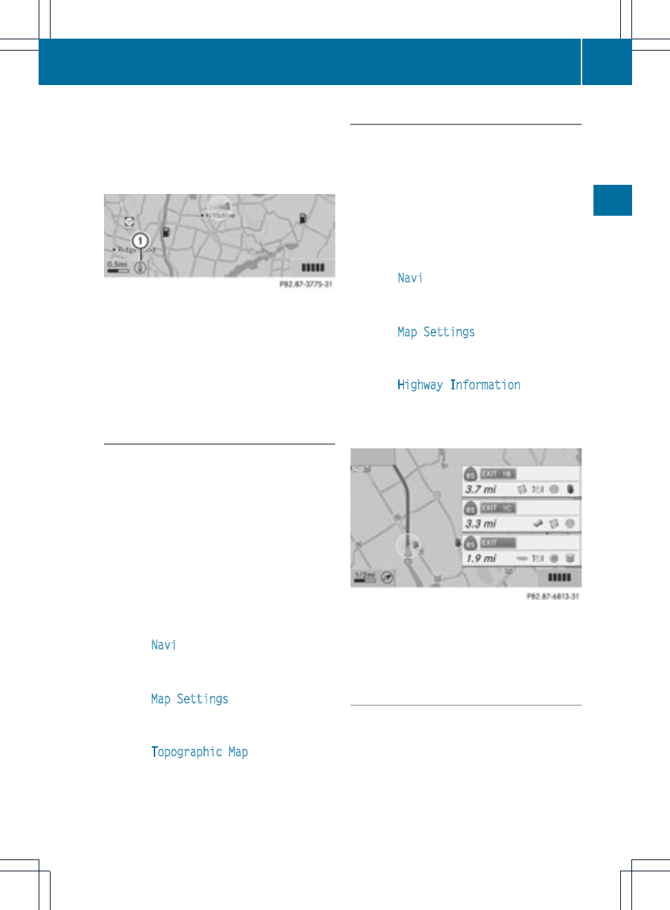
Freeway information
When driving on freeways, you can have the
nearest gas stations, rest areas, etc., as well
as your current distance from them, shown
on the right-hand side of the display.
X
To switch on navigation mode: press the
Ø function button.
X
To show the menu: press W the COMAND
controller.
X
Select
Navi
in the main function bar by
sliding ZV and turning cVd the COMAND
controller and press W to confirm.
X
Select
Map Settings
and press W to
confirm.
The map settings menu appears.
X
Select
Highway Information
and press
W to confirm.
Depending on the previous state, switch
the option on O or off ª.
Example: freeway information
The entries show the number of the freeway
and freeway exits as well as their distance
from the vehicle's current position.
Switching the city model on/off
When the city model is switched on, the map
shows buildings as 3D models.
i
The city model is only shown for "Bird's-
eye view" or "3D map".
It is available for map scales 50 m and
100 m.
Map operation and settings
103
Navi
gati
on
Z