Seiwa Tigershark Plus User Manual
Page 55
57
User Manual
C-LINK NAVIGATION DATA: ACQUISITION AND DISPLAY
As soon as the C-Link navigation data is received, the Slave passes the information
received and executes the relative actions depending on its current working status.
When the Navigation to the external Destination is activated, the Slave Chart
Plotter will show all relevant C-LINK navigation data exactly like when the desti-
nation is not the external one: (Destination Name, DST and BRG to Destination,
calculate XTE, calculate TTG etc). These values will be displayed all places where
required and they will be used to format NMEA-0183 output data.
GRAPHICAL REPRESENTATION ON MAP DISPLAY
Fig. 5.1 - Graphical Displaying
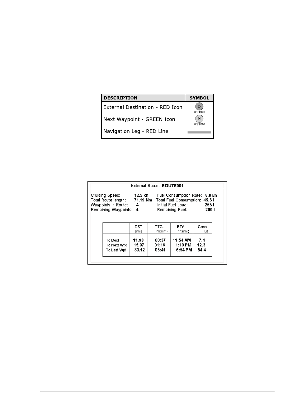
ROUTE DATA REPORT
When the Navigation to the External Route is received, it will be possible to display
the information related to the External Route by entering the Route Data Report.
Fig. 5.1a - External route on Route Data Report
- External Route
: Name of the External Route (from PCMPN,0)
- Cruising Speed
: Planned Cruising Speed (from PCMPN,1)
- Fuel Consumption Rate : Planned Fuel Consumption Rate (from PCMPN,1)
- Total Route length
: Length from First to Last Wpt. (from PCMPN,1)
- Initial Fuel Load
: Volume of Fuel available before the navigation was
started (Liters)
- Total Fuel Consumption : Calculated Fuel consumption to navigate the whole
route.
- Waypoints in Route
: No. of Wpts in the Route (from PCMPN,1)
- Remaining Waypoints
: No. of Wpts from Dest to Last Wpt (from PCMPN,1)
- Distance to Destination : Distance from Ship to Destination (Calculated)
- Distance to Next Wpt
: Distance to travel from ship to the Wpt after the
Destination (calculated: Distance to Dest + Next
Route Leg length)