Creating a field boundary – TeeJet SmartPad II User Guide User Manual
Page 194
5-16
Chapter 5 - Field Mapping
Creating a Field Boundary
Fieldware for Smartpad II
Software Version 4.03
Creating a Field Boundary
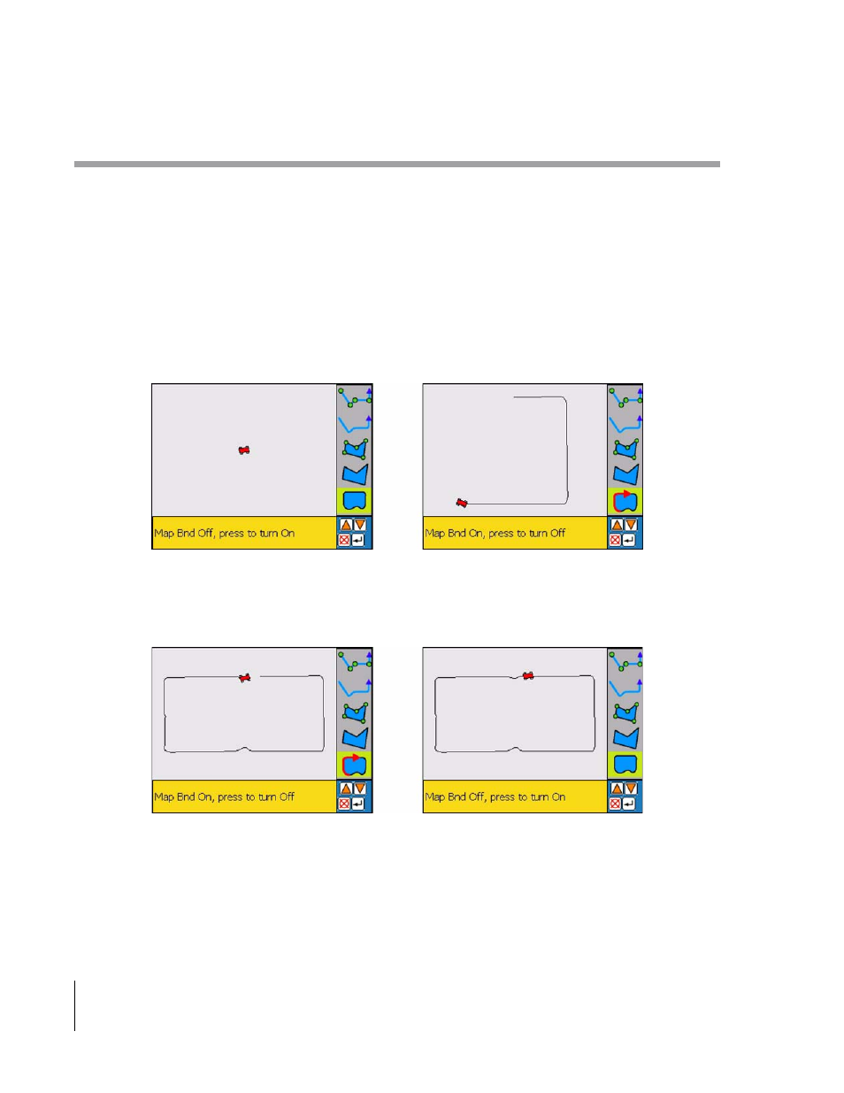
SmartPad II allows you to create a map of the field boundary while mapping or marking points around the perimeter
of the field. If you want to create a field boundary map, you will need to setup SmartPad II to do so. For more infor-
mation on field boundary setup, see “Boundary” on page 2-6.
When SmartPad II is setup to create a field boundary, a Map Boundary button is added to the button bar in the view
page, see Figure 5-17. To start mapping the field boundary, first align the antenna or preset antenna location with the
edge of the field boundary. In the following example, SmartPad II was setup to create a field boundary off the left side
of the vehicle. Next highlight the Map Boundary button and press enter. Once the vehicle begins moving a line repre-
senting the field boundary will be drawn off the left edge of the swath, see Figure 5-17. The boundary will automati-
cally close when the operator approaches the starting point see right image in Figure 5-18
Figure 5-17: Preparing to Map Field Boundary
Figure 5-18: Closing a Field Boundary