Na viga tion, Map operation and map settings – Mercedes-Benz CLA-Class 2014 COMAND Manual User Manual
Page 111
Centering the map on the vehicle's posi-
tion
X
To show the menu: press W the COMAND
controller.
X
Select
Position
Position
in the navigation system
menu bar by sliding VÆ and turning cVd
the COMAND controller and press W to
confirm.
X
Select
Vehicle Position Map
Vehicle Position Map
and press
W to confirm or, if the crosshair is shown,
press the % back button.
This hides the crosshair.
Centering the map on the destination
position
This function requires a calculated route to a
destination. If the route includes way points
and an intermediate stop, the map can also be
set to these positions.
X
To show the menu: press W the COMAND
controller.
X
Select
Position
Position
in the navigation system
menu bar by sliding VÆ and turning cVd
the COMAND controller and press W to
confirm.
X
Select
Destination Position Map
Destination Position Map
and
press W to confirm.
The crosshair position is set to the relevant
destination.
Map settings
Calling up the map settings menu
X
To show the menu: press W the COMAND
controller.
X
Select
Navi
Navi
in the main function bar by
sliding ZV and turning cVd the COMAND
controller and press W to confirm.
X
Select
Map
Map Settings
Settings
and press W to con-
firm.
The map settings menu appears.
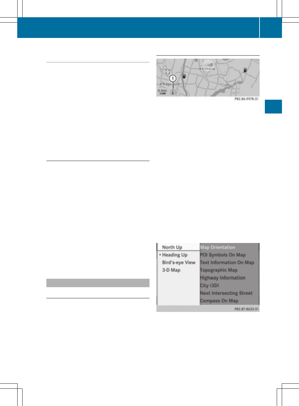
Map orientation
Example: map orientation
:
Current map orientation (0 or ¤)
Possible map orientations:
R
0 North orientation (The map view is dis-
played so that north is always up)
R
¤ Heading orientation (the map view is
aligned to the direction of travel. The direc-
tion of travel is always at the top, the
orange-color tip of the symbol points
north.)
R
¤ Bird's-eye view (the map view is aligned
to the direction of travel. The map projec-
tion reproduces the curvature of the earth's
surface, the orange-color tip of the symbol
points north.)
R
¤ 3D map (the map view is aligned to the
direction of travel. At a scale of 1 km the
map displays elevation, the orange-color
tip of the symbol points north.)
Map orientation menu
Setting the map orientation
X
To show the menu: press W the COMAND
controller.
Map operation and map settings
109
Na
viga
tion
Z
- C-Coupe 2014 COMAND Manual C-Sedan 2014 COMAND Manual B-Class 2014 E-Cab 2014 COMAND Manual E-Coupe 2014 COMAND Manual E-Wagon 2014 COMAND Manual E-Sedan 2014 COMAND Manual GLK-Class 2014 COMAND Manual G-Class 2014 COMAND Manual M-Class 2014 COMAND Manual SLK-Class 2014 COMAND Manual SLK-Class 2015 COMAND Manual M-Class 2015 COMAND Manual GLK-Class 2015 COMAND Manual GLA-Class 2015 COMAND Manual C-Coupe 2015 COMAND Manual