Campbell Scientific HydroSense II Support Software User Guide User Manual
Page 40
Section 4. Viewing Data
A toolbar is located on the right of the map. It contains tools to change zone
sizes and positions. See
SECTION 4.5.6.1 Zone Editing Tools
instructions on how to use this toolbar.
A zoom slider is located on the left-hand side of the main map. This can be
used to change the current zoom level in increments by clicking the + and -
buttons or continuously zooming in by using the slider.
If Google Earth is installed on the local computer, clicking the button at the
lower-right of the map will show the contents of the view in Google Earth.
More information on this can be found in
SECTION 4.5.5 Show in Google
(p. 4-19).
Zones
Zones are shown to scale on the map. The relative sizes of the zones match the
diameters chosen on the HydroSense II. Each zone is colored according to the
average VWC of all points contained in the zone. Colors used to represent
different levels of VWC can be changed as described in
SECTION 5.3.4
(p. 5-8).
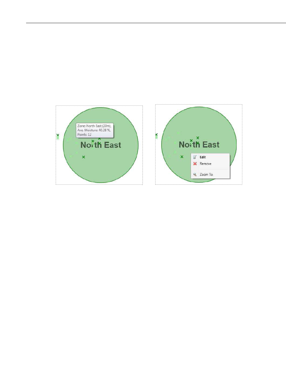
Pausing the pointer over a zone will produce an infotip that lists the average
VWC of this zone and the zone diameter and number of contained points. The
diameter of the zone is shown in brackets next to the zone name.
Right-clicking on the zone shows the Zone Context menu, which has the
following commands:
• Edit — opens the Edit Zone window where the zone name and diameter
can be changed. For more information, see
SECTION 4.5.6 Edit Zone
(p. 4-21).
• Zoom To — zoom in to the current map view to show only the selected
zone.
• Remove — removes the zone from the software and from the HydroSense
II device on the next synchronization. A dialog box will ask the user to
confirm this action.
4-14