4 editing air spaces, Editing air spaces, Operation manual flytec 6040 gps – Flytec 6040 * User Manual
Page 40
Operation Manual FLYTEC 6040 GPS
38
After having called up this function it is at first required to click into the list in order to activate
all Air Spaces contained in the list. The graph is displayed in the right side part of the screen.
The activated Air Space is each time marked in red.
From Flychart Version 4.52.31 on it is possible to display Air Spaces also graphically by using the
mouse in Map mode, which may then be selected or dropped with the right side mouse button.
4.2.2.4 Editing
Air
Spaces
In the same dropdown menu some more activities may be
executed:
with „alter“ („alter...“) it is possible to alter the name, comment
or also the coordinates.
With „new“ (new...“) it is possible to enter new Air Spaces manually.
This is convenient for specific Air Spaces such as wildlife protective
areas or exceptions in official Air Spaces made on bilateral agreement.
With „delete“ („delete“) Air Spaces are erased from the list.
With double-click of the left side mouse button access is given to
the detail view screen.
The name can be altered user defined with the right side mouse button ->alter ( -> alter).
One and the same name is only admitted once in the list and may contain up to maximum
17 characters. We recommend to apply a clearly comprehensible abbreviation. As a standard
are used for data files of the DAFIF data base the official 3-digit aviation name of the airfield,
as well as an abbreviation of the type and of the radio channel. However this results in double
names in the list, because the description may be longer than 17 characters and is then
barely comprehensible.
The description can be altered user defined with the right side mouse button ->alter ( -> alter).
This description is displayed on the instrument and may also contain up to maximum 17 characters.
We recommend to apply a clearly comprehensible abbreviation of the Air Space, as well as
complementary information, such as upper or lower height limits or the radio channel data of
the control tower. As a standard the altitude is indicated in meter or as Flight Level in the
DAFIF data files.
The warning distance is the vertical distance to the Air Space from which on a warning is
emitted in the lower info line of the instrument. The warning displays an abbreviation of the name
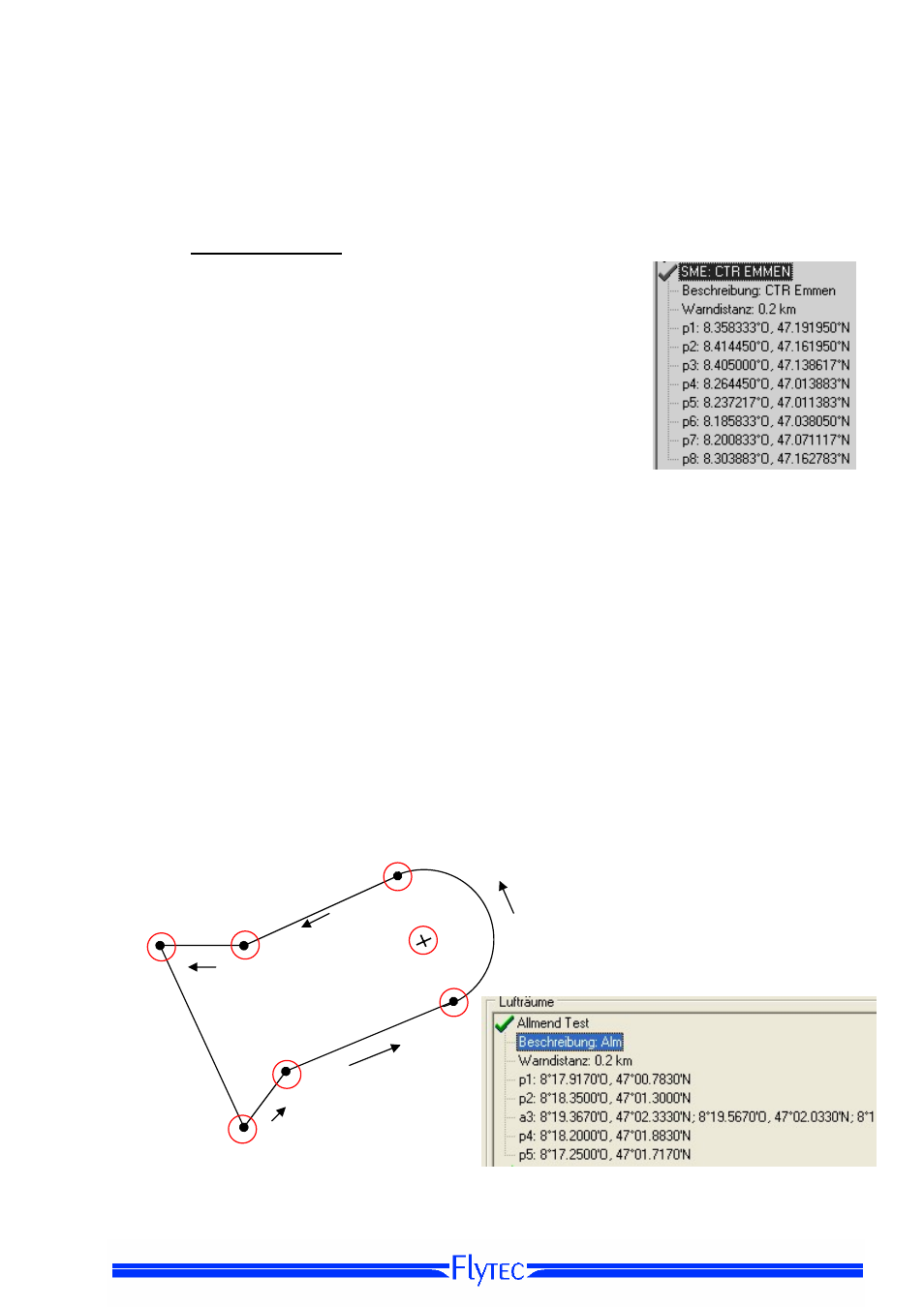
and the remaining distance. The coordinates of key points need to be entered in the sequence of key points
of the polygon.
The rotational direction can be clockwise or counter-clockwise
Coordinates of key points
Example
counter-clockwise
p 5
p 4
a 3
Dir -
3 Center
p 2
p1