Map of flight obstacles (restricted areas), 1 flight obstacles – edit manually, Flight obstacles – edit manuall – Flytec 6040 * User Manual
Page 36: 34 no, 4map of flight obstacles (restricted areas), Operation manual flytec 6040 gps
Operation Manual FLYTEC 6040 GPS
34
4
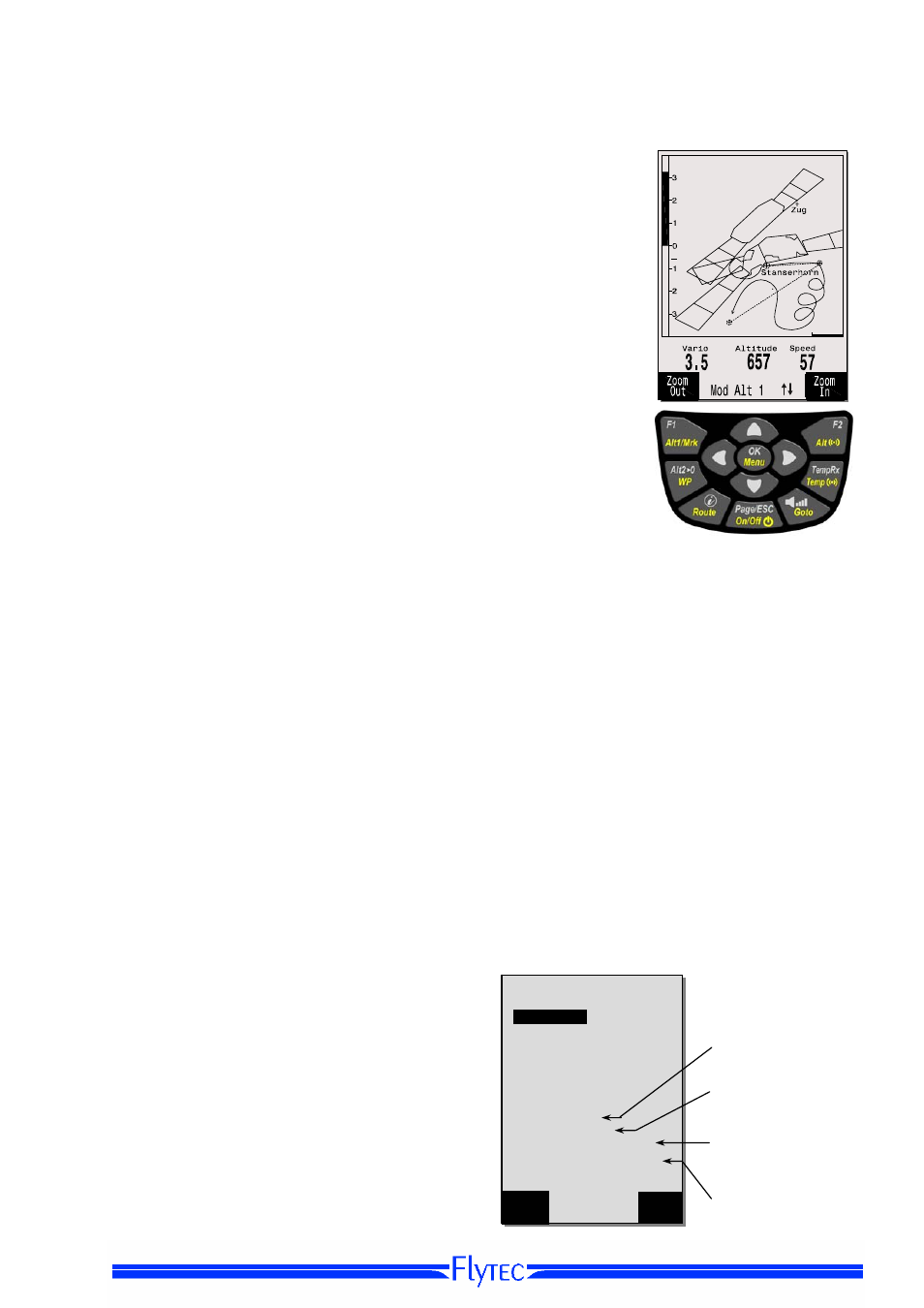
Map of Flight Obstacles (Restricted areas)
It is possible to enter on the FLYTEC 6040 GPS up to 300 flight
obstacles such as CTR’s, TMA’s, air fields, danger areas, cables or
also a wildlife protective area, of which the graphs are displayed on the
map page. These restricted area zones may comprise straight lines,
but also arc segments or just circles. These sectors are displayed in
map mode. Each CTR may be composed of max. 110 Waypoints. As
soon as the distance to CTR falls short of a warning limit to be set in
Setup Mode (factory setting = 200m), this distance is displayed
additionally on the graphic map screen, as well as on the standard flight
display in the Info line. CTR 0.20 Km The distance to the next CTR
can also be displayed as user defined data field.
If the pilot is inside of the CTR, then Dist.to CTR is always indicated as
being 0.
For each CTR is assigned a name and a comment to be freely edited
by the pilot. The names of the five next Air space CTR’s may be shown
with the
i
key in Map Mode. The relevant comment may be used to
inform the pilot during flight about the upper or lower border limits of
the CTR. The sequence of these CTR’s corresponds to the distance
from the momentary position. A second pressing on the
i
key removes
this information, or the Info page disappears after 30 seconds.
The map section can be altered as follows:
F2: Zoom in: the map scale is gradually increased up to approx. 0,5 km.
Thus even details are clearly recognisable.
F1: Zoom out:
the map scale is gradually decreased, down to the
screen-optimised illustration. Maximum is 50 km.
4.1 Flight obstacles – Edit manually
CTR's can be entered into the instrument either manually under Main Setup Menu
⇒
Air Space
or
more easily by use of a PC program, e.g. Flychart which is available for download via Internet
on our homepage (ually setting, altering and deleting CTRs
is operated according to the same system which is used for setting, altering and deleting Waypoints
and Routes.
it is possible to use up to 300 CTR’s, depending
on how complex these are. You can under
Main Setup Menu -> Manage Memory -> Delete
All Air Space
store the CTR Innsbruck into the
instrument and subsequently alter it under Main
Setup Menu -> Air Space.
+
Buho
10
Number
Elements / Points
Comments
Warning Dist.
Restricted areas
-------------------------------------
Innsbruck
ck
---------------------------------
Ctr
1
CTR Innsbruck
Bemerkungen!
Warning Dist.[m]: 50
No of Elements: 7
------------------------------------
Ins
CTR
Del
CTR