Operation manual flytec 6040 gps – Flytec 6040 * User Manual
Page 37
Operation Manual FLYTEC 6040 GPS
35
Innsbruck
- - - - - - - - - - - - - - - - - - - -
Point 1/7
Point 2/7
Center 3/7
Startb 4/7
Stopb 5/7
Point 6/7
Point 7/7
- - - - - - - - - - - - - - - - - - - -
Point
Dir
Lati:
N 47’19.500
Longi:
E011’04.500
- - - - - - - - - - - - - - - - - - - -
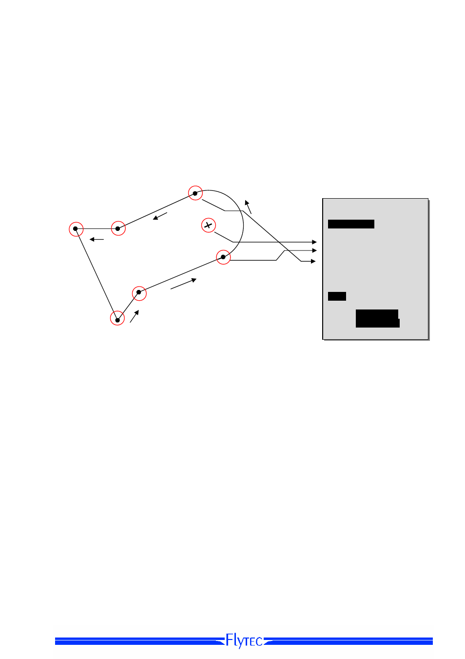
The CTR is defined by key points and arc segments or just by a circle. When entering these
key points it must be taken care of that the key points are precisely created in their order of
appearance (to the right or to the left) in which these lines should be displayed later.
The FLYTEC 6040 GPS draws automatically a line from the recent Waypoint to the first one.
It is therefore not necessary to repeat as last waypoint the first one.
As type the following elements can be selected:
Point:
key point
Center:
centre of arc segment
Startboarder: start
point of arc segment
Stopboarder:
end point of arc segment
Circle:
centre of the circle plus Radius
Example
counter-clockwise
To enter arc segments, the following sequence must be observed:
Long, Lat centre;
Long, Lat start point of arc segment;
Long, Lat end point of arc segment;
Rotational direction (+clockwise, - counter-clockwise
For circles the centre and the Radius are sufficient.
Long, Lat of centre;
Radius in km
7. Point
6. Point
5 Stopboarder
Dir -
4 Startboarder
Dir -
3 Center
2. Point
1. Point
6. Point
1. Point
2. Point