Appendix b – Garmin G1000 Quest Kodiak User Manual
Page 468
190-00590-02 Rev. A
Garmin G1000 Pilot’s Guide for the Quest Kodiak 100
SY
STEM
O
VER
VIEW
FLIGHT
INSTRUMENTS
EIS
AUDIO P
ANEL
& CNS
FLIGHT
MANA
GEMENT
HAZARD
AV
OID
ANCE
AFCS
ADDITIONAL FEA
TURES
APPENDICES
INDEX
456
APPENDIX b
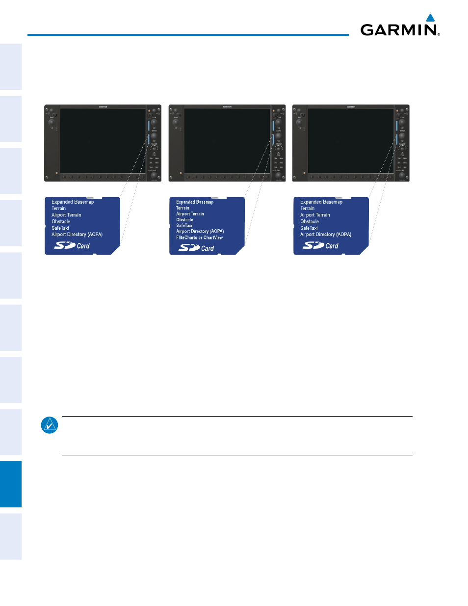
After subscribing to the desired database product, these database products will be downloaded to three
Supplemental Data Cards (with the exception of FliteCharts, which is loaded on only one card). Insert each
Supplemental Data Card into the correct location shown in Figure B-5. These cards must not be removed
except to update the databases stored on each card.
Figure B-5 Correct Database Locations
MFD
PFD1
PFD2
Since these databases are not stored internally in the displays, a Supplemental Data Card containing identical
database versions must be kept in each display unit.
The basemap database contains data for the topography and land features, such as rivers, lakes, and towns.
It is updated only periodically, with no set schedule. There is no expiration date.
The terrain database contains the terrain mapping data. The airport terrain database contains increased
resolution terrain data around airports. These databases are updated periodically and have no expiration date.
The obstacle database contains data for obstacles, such as towers, that pose a potential hazard to aircraft.
Obstacles 200 feet and higher are included in the obstacle database. It is very important to note that not all
obstacles are necessarily charted and therefore may not be contained in the obstacle database. This database is
updated on a 56-day cycle.
NOTE:
The data contained in the terrain and obstacle databases comes from government agencies. Garmin
accurately processes and cross-validates the data, but cannot guarantee the accuracy and completeness of
the data.
The AOPA Airport Directory provides data on airports and heliports throughout the U.S., and offers detailed
information for over 5,300 U. S. airports, along with the names and phone numbers of thousands of FBOs. This
database is updated four times per year and has no expiration date
The SafeTaxi database contains detailed airport diagrams for selected airports. These diagrams aid in following
ground control instructions by accurately displaying the aircraft position on the map in relation to taxiways,
ramps, runways, terminals, and services. This database is updated on a 56-day cycle.
The FliteCharts database contains procedure charts for the United States only. This database is updated on a
28-day cycle. If not updated within 180 days of the expiration date, FliteCharts will no longer function.