Hazard avoidance metars and tafs – Garmin G1000 Quest Kodiak User Manual
Page 313
190-00590-02 Rev. A
Garmin G1000 Pilot’s Guide for the Quest Kodiak 100
SY
STEM
O
VER
VIEW
FLIGHT
INSTRUMENTS
EIS
AUDIO P
ANEL
& CNS
FLIGHT
MANA
GEMENT
HAZARD
AV
OID
ANCE
AFCS
ADDITIONAL
FEA
TURES
APPENDICES
INDEX
301
HAZARD AVOIDANCE
METARS AND TAFS
NOTE:
Atmospheric pressure as reported for METARs is given in hectopascals (hPa), except for in the United
States, where it is reported in inches of mercury (in Hg). Temperatures are reported in Celsius.
NOTE:
METAR information is only displayed within the installed aviation database service area.
METARs (METeorological Aerodrome Reports) typically contain information about the temperature,
dewpoint, wind, precipitation, cloud cover, cloud heights, visibility, and barometric pressure at an airport or
observation station. They can also contain information on precipitation amounts, lightning, and other critical
data. METARs reflect hourly observations; non-routine updates include the code “SPECI” in the report.
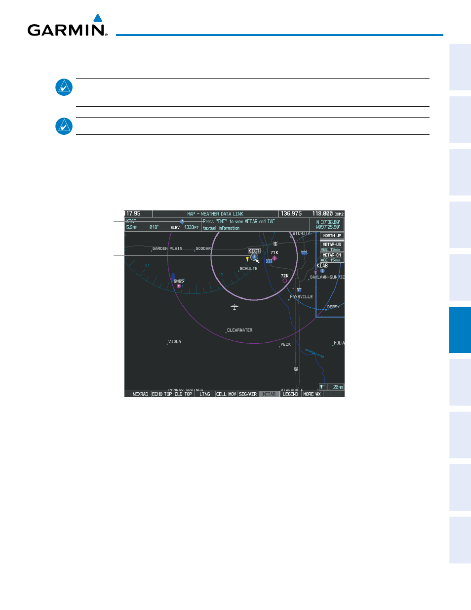
METARs are shown as colored flags at airports that provide them.
Figure 6-25 METAR Flags on the Weather Data Link Page
Instructions for
Viewing METAR
and TAF Text
Selected Airport
TAFs (Terminal Aerodrome Forecasts) are weather predictions for specific airports within a 24- hour period,
and may span up to 36 hours. TAFs typically include forecast wind, visibility, weather phenomena, and sky
conditions using METAR codes.
METAR and TAF text are displayed on the Weather Information Page. METAR data is displayed first in a
decoded fashion, then as raw text. TAF information is displayed only in its raw form when it is available.
Displaying METAR and TAF text:
1)
On the Weather Data Link Page, press the METAR Softkey.
2)
Press the RANGE Knob and pan to the desired airport.
3)
Press the ENT Key. The Weather Information Page is shown with METAR and TAF text.