Hazard avoidance, Zoom range on the navigation map – Garmin G1000 Quest Kodiak User Manual
Page 327
190-00590-02 Rev. A
Garmin G1000 Pilot’s Guide for the Quest Kodiak 100
SY
STEM
O
VER
VIEW
FLIGHT
INSTRUMENTS
EIS
AUDIO P
ANEL
& CNS
FLIGHT
MANA
GEMENT
HAZARD
AV
OID
ANCE
AFCS
ADDITIONAL
FEA
TURES
APPENDICES
INDEX
315
HAZARD AVOIDANCE
If heading input is lost, strikes and/or cells must be cleared manually after the execution of each turn
(Figure 6-41). This is to ensure that the strike and/or cell positions are depicted accurately in relation to the
nose of the aircraft.
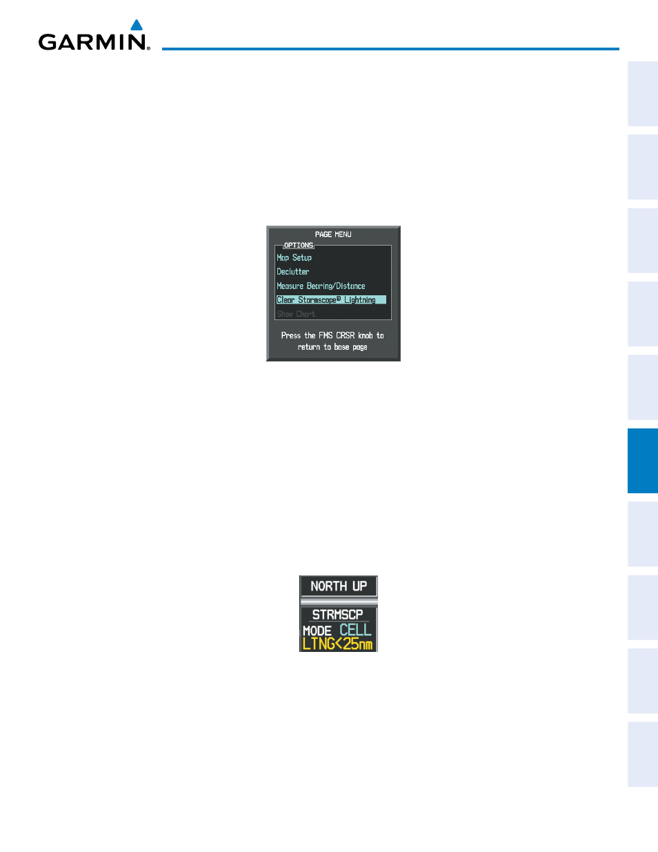
Manually clearing Stormscope data on the Navigation Map:
1)
Press the
MENU
Key.
2)
Select ‘Clear Stormscope Lightning
®
’.
3)
Press the
ENT
Key.
Figure 6-48 Navigation Map Page Options Menu
ZOOM RANGE ON THE NAVIGATION MAP
Stormscope lightning data can be displayed up to 800 nm zoom range (in North up mode) on the Navigation
Map Page. However, in the track up mode at the 500 nm range, a portion of Stormscope lightning data
can be behind the aircraft and therefore not visible on the Navigation Map. Since the range for Stormscope
data is 400 nm diameter total (200 nm in front and 200 nm behind), the 500 nm range in North up mode
shows all the data.
At a map range of less than 25 nm, Stormscope lightning data is not displayed, but can still be present. The
presence of Stormscope lightning data is indicated by the annunciation ‘LTNG < 25 nm’ in the upper right
corner (Figure 6-49).
Figure 6-49 Lightning Display Range Annunciation