System overview, Mfd softkeys – Garmin G1000 Quest Kodiak User Manual
Page 33
190-00590-02 Rev. A
Garmin G1000 Pilot’s Guide for the Quest Kodiak 100
SYSTEM OVERVIEW
SY
STEM
O
VER
VIEW
FLIGHT
INSTRUMENTS
EIS
AUDIO P
ANEL
& CNS
FLIGHT
MANA
GEMENT
HAZARD
AV
OID
ANCE
AFCS
ADDITIONAL
FEA
TURES
APPENDICES
INDEX
21
SY
STEM
O
VER
VIEW
FLIGHT
INSTRUMENTS
EIS
AUDIO P
ANEL
& cNS
FLIGHT
MANA
GEMENT
HAZARD
AV
OID
ANCE
AFCS
ADDITIONAL
FEA
TURES
APPENDICES
INDEX
Garmin G1000 Pilot’s Guide for the Quest Kodiak 100
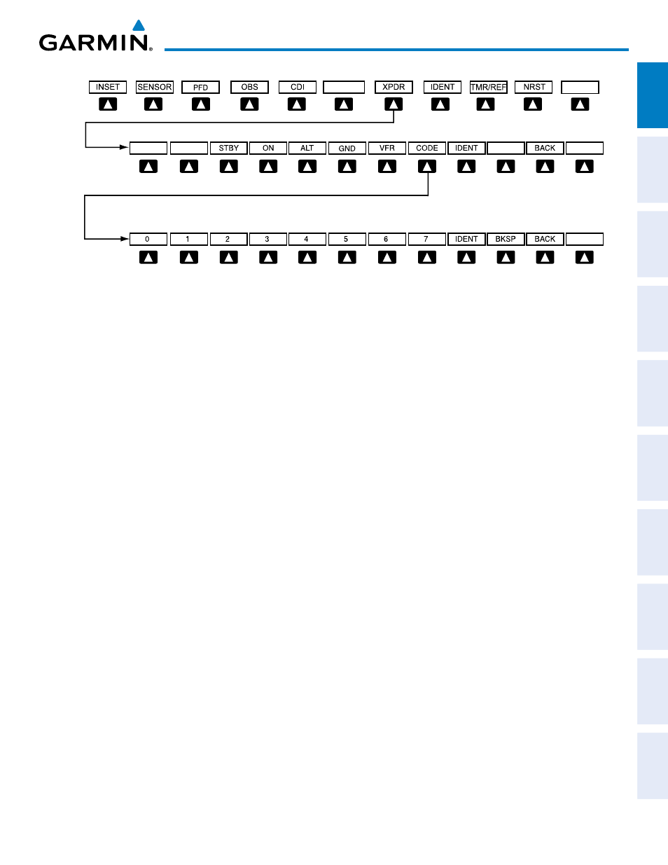
Figure 1-19 XPDR Softkeys
Select the
BACK Softkey to return
to the top-level softkeys.
Select the
BACK Softkey to return
to the previous level softkeys.
ALERTS
ALERTS
ALERTS
MFD SOFTKEYS
ENGINE
Enables second-level Engine Indication System softkeys
ENGINE
Displays oil,electrical, and fuel sliders
SYSTEM
Displays ice protection quantity slider and oil/electrical digital values
FUEL
Displays fuel system quantities and calculations
DEC FUEL
Decreases calculated fuel remaining by 10 lbs for each softkey press
INC FUEL
Increases calculated fuel remaining by 10 lbs for each softkey press
RST FUEL
Resets calculated fuel remaining to default value
MAP
Enables second-level Navigation Map softkeys
TRAFFIC
Displays traffic information on Navigation Map
TOPO
Displays topographical data (e.g., coastlines, terrain, rivers, lakes) and elevation scale
on Navigation Map
TERRAIN
Displays terrain information on Navigation Map
AIRWAYS
Displays airways on the map; cycles through the following:
AIRWAYS: No airways are displayed
AIRWY ON: All airways are displayed
AIRWY LO: Only low altitude airways are displayed
AIRWY HI: Only high altitude airways are displayed
(Default label is dependent on map setup option selected)
STRMSCP
Displays Stormscope information on Navigation Map (optional)
NEXRAD
Displays NEXRAD weather and coverage information on Navigation Map (optional)
XM LTNG
Displays XM lightning information on Navigation Map (optional)
BACK
Returns to top-level softkeys