Data lines to define a local coordinate system – ABAQUS Volume II: I–Z User Manual
Page 541
*SYSTEM
18.56
*SYSTEM:
Specify a local coordinate system in which to define nodes.
This option is used to define nodes by accepting coordinates relative to a specified local rectangular coordinate
system and generating the nodal coordinates in the global coordinate system.
Products:
ABAQUS/Standard
ABAQUS/Explicit
Type:
Model data
Level:
Part, Part instance
Reference:
•
“Node definition,” Section 2.1.1 of the ABAQUS Analysis User’s Manual
There are no parameters associated with this option.
Data lines to define a local coordinate system:
First line:
1.
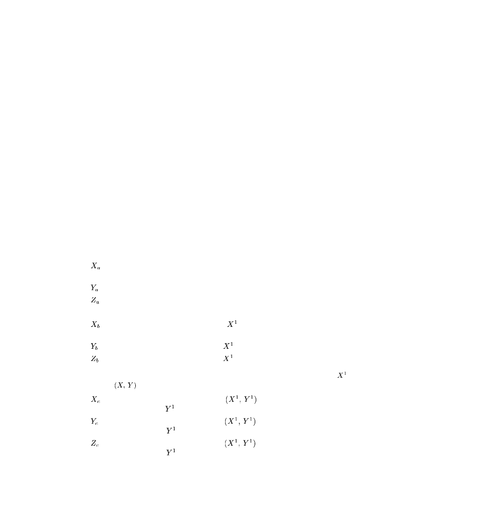
, global X-coordinate of the origin of the local coordinate system (point a in
2.
, global Y-coordinate of the origin of the local coordinate system.
3.
, global Z-coordinate of the origin of the local coordinate system.
The following entries are not needed for a pure translation:
4.
, global X-coordinate of a point on the
-axis of the local coordinate system (point b in
5.
, global Y-coordinate of a point on the
-axis of the local coordinate system.
6.
, global Z-coordinate of a point on the
-axis of the local coordinate system.
Second line (optional; if not provided, the
Z-axis direction remains unchanged, and the
-axis
is projected onto the
plane):
1.
, global X-coordinate of a point in the
plane of the local coordinate system, on
the side of the positive
-axis (for example, point c in Figure 18.56–1).
2.
, global Y-coordinate of a point in the
plane of the local coordinate system, on
the side of the positive
-axis.
3.
, global Z-coordinate of a point in the
plane of the local coordinate system, on
the side of the positive
-axis.
18.56–1
ABAQUS Version 6.1
Module: ID:
Printed on: