User guide, 3 waypoints, 1 configuring waypoints – Eagle Tree Vector User Manual
Page 71: 2 showing waypoints on the osd
USER GUIDE
71
7.3 Waypoints
The Vector supports up to 26 waypoints. The Vector displays the Waypoints graphically on the OSD screen,
making it easy for you to fly to them manually.
At this time, the Vector will not
autonomously fly to waypoints.
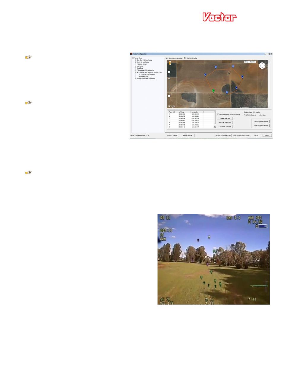
7.3.1 Configuring Waypoints
Waypoints are configured in the software, by
selecting the “GPS Waypoints Setup” tab.
Internet connection is required to
configure waypoints.
On this tab, you can zoom in to the desired
area, and add your waypoints by just clicking
on the map.
You can also configure the first waypoint (Waypoint A) to be the home position. This lets you set the home
point without needing to move the model physically to that point.
Check the “User Waypoint A as Home Position” checkbox to enable this feature.
For the Home Waypoint feature to work, the model must get its first GPS position fix within about 500
feet (152 meters) of the programmed home waypoint. Otherwise, an error message will appear in the
notification area, and the current GPS position will be used instead.
7.3.2 Showing Waypoints on the OSD
To display waypoints on the Vector OSD screen, navigate to the “Advanced Graphics/Indicators” menu from the
OSD Setup menu.
On that page, change the “Waypoints” item to “Scrn 1” to
display the waypoints on the main OSD screen.
Once the GPS gets a good fix, the waypoints will appear
graphically on the screen. The waypoints are color coded,
to let you know which waypoint to fly to next (in sequence
from Waypoint A to the last waypoint you configured).
l) Next waypoint – yellow with black outline
m) Visited waypoints – green with black outline
n) Unvisited waypoints – purple with black outline
As you fly over the next waypoint, it changes from yellow
to green, and the next waypoint in the sequence turns
yellow.
The scaling of the waypoints on the screen is based on the “RADAR Maximum Radius” setting in the “Graphics
and Indicators Setup” menu. If a waypoint is farther away than the maximum setting, the colors are inverted
(the next waypoint would be black with yellow outline, for example).