4 map page – Garmin GPS 500 User Manual
Page 32
GPS 500 Pilot’s Guide and Reference
SECTION 2
NAV PAGES
2-6
190-00181-60 Rev. G
2.4 MAP PAGE
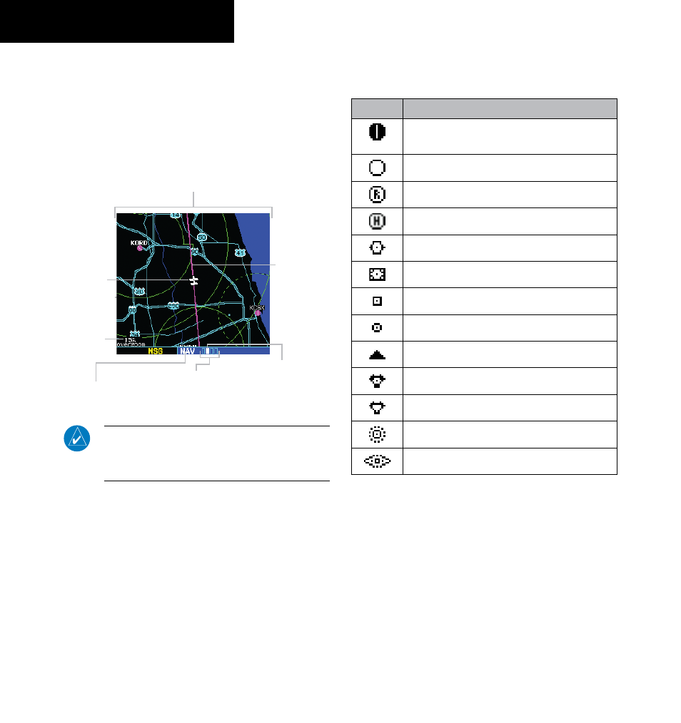
The second NAV page is the Map Page (Figure 2-9),
which displays the present position using an airplane
symbol, along with nearby airports, NAVAIDS, user-
defined waypoints, airspace boundaries, lakes, rivers,
highways, and cities.
Figure 2-9 Map Page
Present
Position
Desired Track
Map Range
Map Display
Current Page Group
Number of Pages in
Current Page Group
Position of Current
Page within Current
Page Group
NOTE: If the GPS 500 is unable to determine
a GPS position, the present position (airplane)
symbol does not appear on the Map Page.
Different symbols are used to distinguish between
waypoint types. The identifiers for any on-screen
waypoints can also be displayed. (The identifiers are
enabled by default.) Special-use and controlled airspace
boundaries appear on the map, showing the individual
sectors for Class B, Class C, and Class D airspaces.
Table 2-3 shows the symbols used to depict the various
airports and NAVAIDS on the Map Page.
Symbol
Description
Airport with hard surface runway(s); (primary
runway shown)
Airport with soft surface runway(s) only
Private Airfield
Heliport
VOR
VOR/DME
DME
Localizer
Intersection
VORTAC
TACAN
NDB
Locator Outer Marker
Table 2-3 Map Page Symbols
The Map Display can be set to 23 different range
settings from 500 feet to 2000 nautical miles (statute and
metric units are also available). The range is indicated
in the lower left-hand corner of the Map Display (Figure
2-9), and represents the top-to-bottom distance covered
by the Map Display.
Selecting a map range:
1) Press the up arrow of the RNG Key to zoom
out to a larger map area.
2) Press the down arrow of the RNG Key to zoom
in to a smaller map area and more detail.