Garmin GPS 500 User Manual
Page 16
GPS 500 Pilot’s Guide and Reference
1-8
SECTION 1
INTRODUCTION
190-00181-60 Rev. G
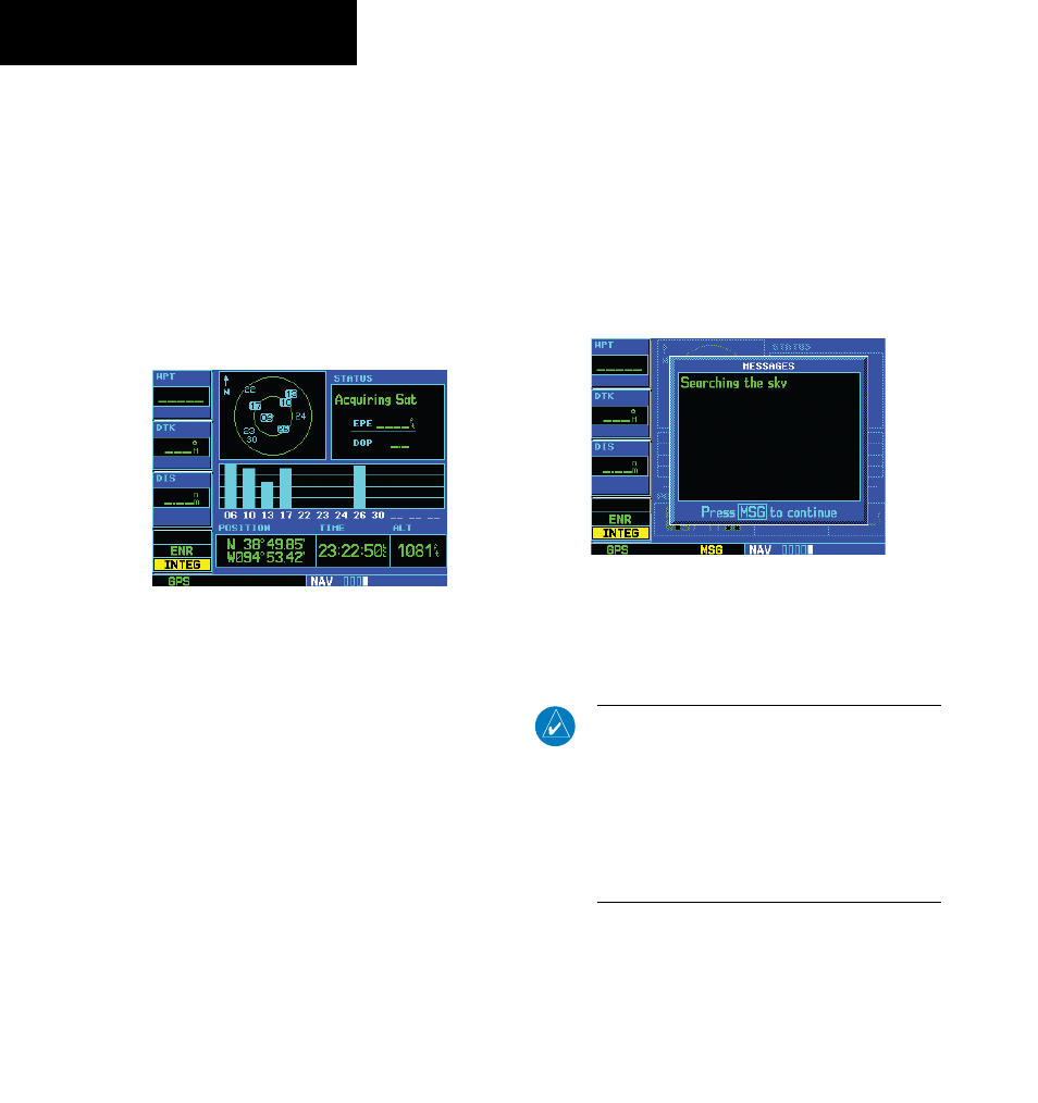
Satellite Status Page
The Satellite Status Page (Figure 1-10) appears as the
GPS 500 attempts to collect satellite information.
When an ‘Acquiring’ status is displayed on the Satellite
Status Page, the signal strengths of any satellites received
appear as ‘bar graph’ readings. This is a good indication
that the unit is receiving signals and a position fix is being
determined. Following the first-time use of the GPS 500,
the time required for a position fix varies, usually from
one to two minutes.
Figure 1-10 Satellite Status Page
If the unit can only obtain enough satellites for 2D
navigation (no altitude), the unit uses the altitude provided
by the altitude encoder (if one is connected).
The ‘INTEG’ annunciator (bottom left corner of the
screen) indicates that satellite coverage is insufficient to
pass built-in integrity monitoring tests. In the example
above, not enough satellites are being received to determine
a position. The Satellite Status Page shows the ID numbers
for the satellites and the relative signal strength of each
satellite received (as a bar graph reading).
‘Searching Sky’ indicates that satellite almanac data is
not available or has expired (if the unit hasn’t been used
for six months or more). This means the unit is acquiring
satellite data to establish almanac and satellite orbit
information, which can take five to ten minutes. The data
is recollected from the first available satellite. The Satellite
Status Page displays a ‘Search Sky’ status, and the message
annunciator (MSG), above the MSG Key also flashes to
alert the pilot of system message, ‘Searching the Sky’.
Viewing a system message:
Press the MSG Key (Figure 1-11).
The Message Page appears and displays the status or
warning information applicable to the receiver’s current
operating condition.
Figure 1-11 Message Page
Returning to the previous page after
viewing a message:
Press the MSG Key again.
NOTE: The GPS 500 utilizes certain software
algorithms to ensure reliable GPS receiver
operation. Receiver Autonomous Integrity
Monitoring (RAIM) and Fault Detection and
Exclusion (FDE) are two examples. These features
allow navigation during Oceanic/Remote legs of
a flight using the GPS 500. For further details,
please refer to Sections 8.3, 8.4, and 11.