Section 9: vertical navigation (vnav) – Garmin GPS 500 User Manual
Page 163
GPS 500 Pilot’s Guide and Reference
SECTION 9
VERTICAL NAVIGATION
9-1
SECTION 9: VERTICAL
NAVIGATION (VNAV)
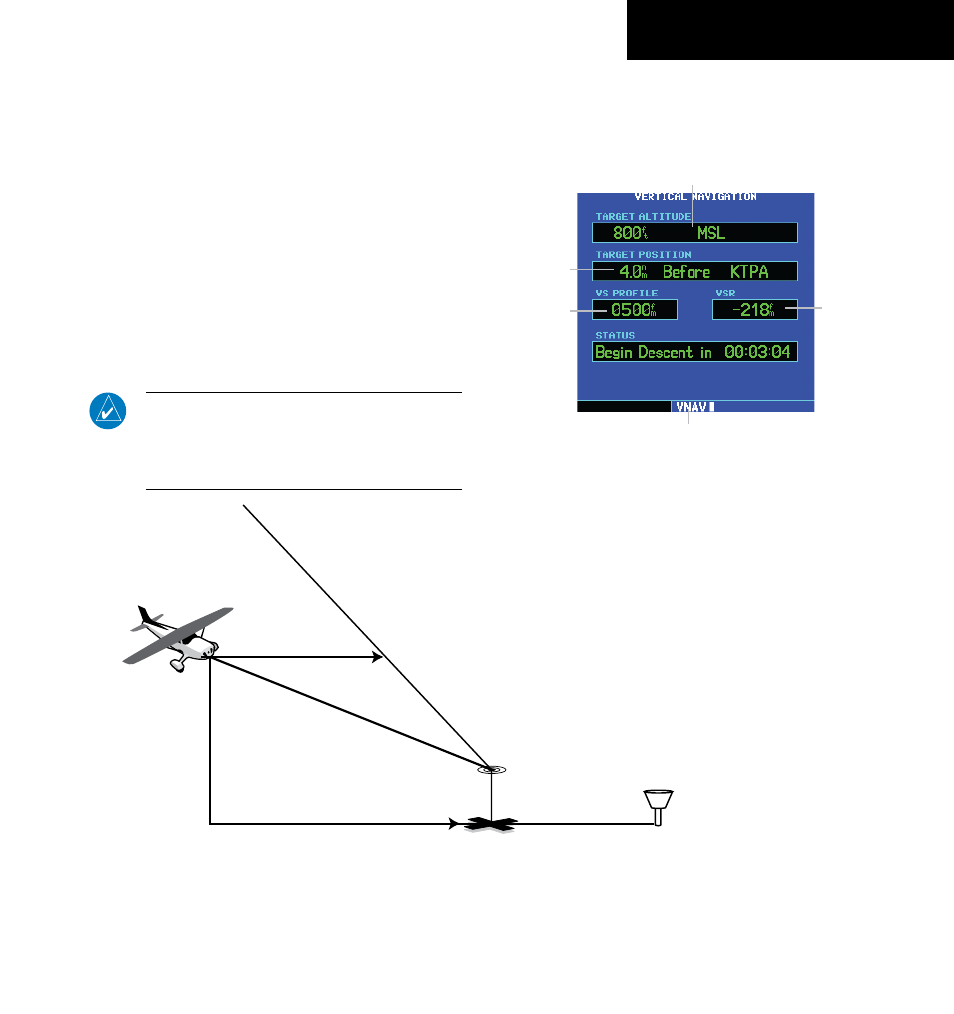
The GPS 500’s Vertical Navigation Page (Figure 9-2)
allows you to create a three-dimensional profile (Figure
9-1) which guides you from your present position and
altitude to a final (target) altitude at a specified location.
This is helpful when you’d like to descend to a certain
altitude near an airport or climb to an altitude before
reaching a route or direct-to waypoint. Once the profile is
defined, message alerts and additional data on the Default
NAV and Map Pages keep you informed of your progress.
NOTE: To use the vertical navigation features,
the ground speed must be greater than 35 knots
and direct-to navigation or a flight plan must be
activated.
Figure 9-1 VNAV Profile
VER
TICAL NA
VIGA
TION PR
OFILE
VER
TICAL SPEED
REQUIRED
DISTANCE TO TARGET
TIME AND DISTANCE
TO PROFILE
TARGET ALTITUDE
AND POSITION
AIRPORT
CURRENT ALTITUDE
AND POSITION
Displaying the Vertical Navigation Page:
Press the VNAV key.
Figure 9-2 VNAV Page
Current Page
Target Altitude and Altitude
Reference (AGL or MSL)
Target Distance
(from reference)
Vertical Speed
Desired
Vertical
Speed
Required
190-00181-60 Rev. G