Garmin GPS 500 User Manual
Page 164
GPS 500 Pilot’s Guide and Reference
SECTION 9
VERTICAL NAVIGATION
9-2
Creating a vertical navigation profile:
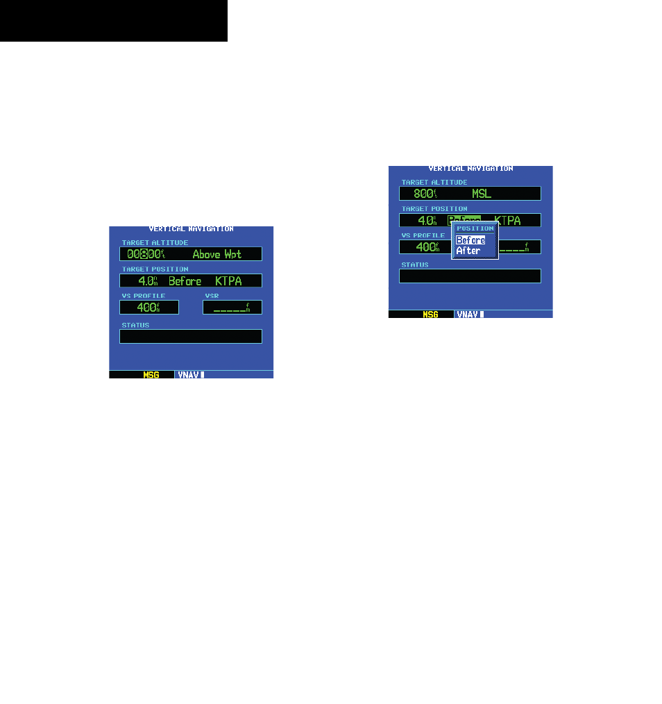
1) Press the VNAV Key to display the Vertical
Navigation Page.
2) Press the small right knob to activate the
cursor.
3) With the TARGET ALTITUDE field highlighted
(Figure 9-3), turn the small and large right
knobs to select the target altitude, and press
the ENT Key.
Figure 9-3 Target Altitude Selected
4) Turn the small right knob to select “Above
Wpt” (AGL) or “MSL” and press the ENT Key.
“Above Wpt” uses the altitude of a destination
airport as stored on the Jeppesen NavData
card. “MSL” lets you set a specific target
altitude for any waypoint category: airport,
VOR, NDB, intersection or user waypoint.
5) Turn the small and large right knobs to select
a distance from the target reference waypoint
and press the ENT Key. If the target altitude
should occur at the target reference waypoint,
enter a distance of zero.
6) Turn the small right knob to select “Before” or
“After” (Figure 9-4), and press the ENT Key.
This setting designates whether the offset
distance defines a point before you reach the
target reference waypoint or after you reach
the waypoint.
Figure 9-4 Position Window
7) When using a flight plan, the target reference
waypoint itself can be specified from the
waypoints contained in the flight plan. By
default, the last waypoint in the flight plan is
selected. To select a different waypoint, turn
the small right knob to select the desired
waypoint and press the ENT Key.
8) The default profile utilizes a 400 foot-per-
minute descent rate. To change the rate, turn
the large right knob to highlight the “VS
Profile” field and use the small and large right
knobs to enter a new rate. Press the ENT Key
when finished.
190-00181-60 Rev. G