Airport information, Airport information 28 – BendixKing SKYMAP IIIC User Manual
Page 71
DETAILED OPERATION
The PETE is calculated on present GS and would read 00:00 if you were stationary. You
can use this function to measure distance, bearing and estimated time en-route to any
point on the map. The window formed by the extremities of the Screen can be moved
around the map by “bumping” the Screen borders left, right, up or down with the pointer. A
PANNING message will be displayed when a border has been bumped in this manner,
while the map screen is redrawn. You can still use Keys 2, ZOOM IN, and 3, ZOOM OUT,
to zoom the map in and out. When you are finished using this Screen press Key 1,
RESET STICK, and the joystick pointer will vanish, your display will return to Screen 38
and the map will be placed back at the aircraft’s present position and at the zoom level it
was at prior to activating the joystick. If you don't move the joystick for 30 seconds, this
will have the same effect as pressing Key 1.
In addition to finding it useful for measuring distances, bearings and ETE's, you can utilise
this Screen for other tasks. If you place the pointer over any data icon and then press Key
4, MORE INFO, Screen 40 (Airport), Screen 40A (Beacon) or Screen 40C (all other data
icons) as illustrated below will appear. These Screens contain additional data and
information on the selected item.
If you want to navigate directly to any position, press Key 5 and you will obtain a DIRECT
TO, taking you to wherever the pointer is positioned, even if it is not pointing to a database
item (NOTE: In this case the waypoint will be shown as ‘TEMP WPT’). This is a very
useful feature for arbitrary in-flight diversions. After you have pressed Key 5, DIRECT TO,
Screen 47, Map Mode with NAV Info, appears, with Key 5 now labelled “DIRECT TO
OFF”.
DETAILE
D
OPE
RATION
Airport Information
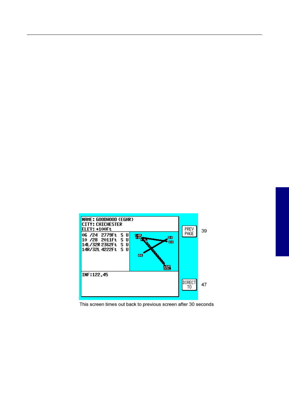
Screen 40: Map Mode Airport Info Screen
As explained above, you can access this Screen from Screen 39 by placing the joystick
pointer over an airport icon and pressing Key 4, MORE INFO. All the information given
here is derived from the built-in Jeppesen database. Runway surfaces are shown as an H
for hard and an S for soft. Lighting is shown as an L for lit and a U for unlit.
To initiate navigation to the chosen airport all you have to do is press Key 5, labelled
DIRECT TO. To return to the Map of Screen 39 you should press Key 1, PREV PAGE.
Alternatively, the unit gives you 30 seconds to read what you require from the Info Screen
Rev 9 Jul 2006
3-28
Skymap/Tracker IIIC Pilot's Guide