Gps and aprs position format, Gps receivers, Garmin gps18xpc – Kenwood TM-D710GE User Manual
Page 19: Gps 03
15
GPS 03
GPS and APRS Position Format
Although position can be described in many different formats, such as degrees, degrees and minutes, and degrees,
minutes and seconds, the GPS system and APRS have standardized on the degrees and decimal minutes format.
Just like it is important to use proper international phonetics when spelling on the air, it is important in APRS as in any
communications system to have a default standard for position. All operators should be trained to use the DDD MM.mm
format by default in voice communications just like in the data formats. Using these standards on the air will prevent
communications errors, confusion, repeats, and conversions.
Table 3-1 APRS Position Format and Example
Geographic Coordinates
Format
Example
Latitude
DD MM.mm
(degrees and minutes)
39 49.31N
+39 49.31
Longitude
DDD MM.mm
(degrees and minutes)
84 15.39W
‑84 15.39
GPS Receivers
GPS without Maps (GPS18xPC or similar)
To GPS jack
Weather Station
GPS with Maps (AvMap G5/G6)
Fig. 3-2 GPS Receivers
Note:
◆ While an internal GPS receiver in the TM‑D710GA/GE is active, an external GPS receiver is deactivated. (No position data
transferred from the external GPS receiver will be processed.)
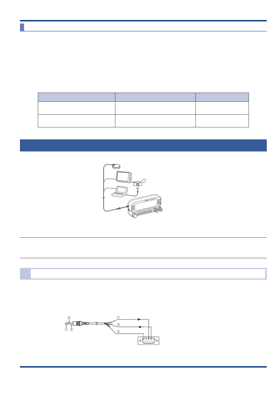
Garmin GPS18xPC
The GPS18xPC is a GPS module receiver that interfaces via a 9‑pin D‑Sub RS‑232C serial port. Refer to the wiring
example using an accessory cable (2.5 mm 3‑conductor plug) that comes with the TM‑D710. Power is sourced from
the 12 VDC supplied from a vehicle cigarette lighter socket. Because there is no screen, you cannot use the Waypoint
function.
5
3 2
GND
RXD
TXD
Pin Allocation viewed from
the Soldered Side
(9-pin D-sub Connector (Male))
Shielded
Red
While
Separately, prepare a 9-pin D-sub Connector (Male)
and wire to the data cable supplied with
TM-D710A/E/GA/GE and RC-D710 as illustrated.
Data Cable supplied with
TM-D710A/E/GA/GE and RC-D710
Fig. 3-3 Garmin GPS18xPC