Defining a user system, Opening an existing job, Viewing the properties of the open job – Spectra Precision ProMark Field Software User Manual
Page 20: Working on points
English
14
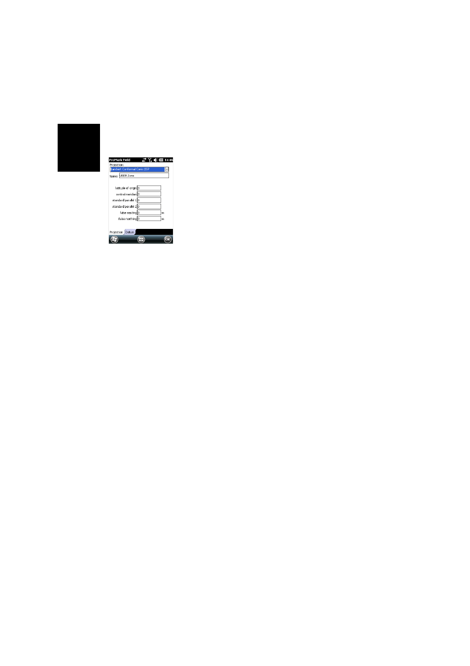
Defining a User
System
• Tap on the
New button.
• Select the type of projection you wish to use in your
coordinate system. Depending on that choice, you will
have to enter a certain number of parameters.
Remember every time you create a new projection and you
have to enter the latitude and longitude of origin, or the
central meridian, these must be expressed in degrees with
eight decimal places (ddd.dddddddd). On the other hand,
false eastings and false northings should always be
expressed in meters, even if a different unit has been
selected in the
Units field on the same screen.
• After you have named and defined your new projection
and datum, just tap
OK to save the new system and choose
it as the system used in the current job. This will take you
back to the coordinate system selection screen on which
you will now be able to see how the new USER coordinate
system has been defined (new projection and datum
names displayed in the second and third fields
respectively).
Opening an
Existing Job
• Tap
Menu>Job>Open.... ProMark Field browses all the
folders in search of all the *.csv or *.shp files stored in the
receiver (depending on how you set the
Type field). A new
window then opens listing all these jobs.
• After you have found the job you wish to open, tap on its
name in the list. This opens the job and takes you to the
map screen where you can see the points already logged
in that job.
Viewing the
Properties of the
Open Job
• Tap
Menu>Job>Properties. ProMark Field then displays a
two-tab window. The first tab provides the job’s name,
type and location (folder). The second one views the
properties (projection and datum) of the coordinate
system used in the job.
• Tap
OK or press ESC to return to the map screen.
Working on Points
You can easily access the complete list of points contained in
a job to perform one of the following functions:
• Find a point
• Edit a point
• Delete a point