Mapping objects using gps – Juniper Systems Juniper Aspect User Manual
Page 74
70
Juniper Aspect Owner’s Manual
Note: A Custom Objects Catalog exists only on mobile
computers. Custom objects are not synchronized to the
desktop or to other mobile computers. They are unique
to each mobile computer. The objects show up in reports
generated on the desktop, but must be manually added
to an object catalog on the desktop computer if desired.
Mapping Objects Using GPS
Objects are typically mapped using GPS, although they
can be added manually (instructions on how to do this
are given later in this manual).
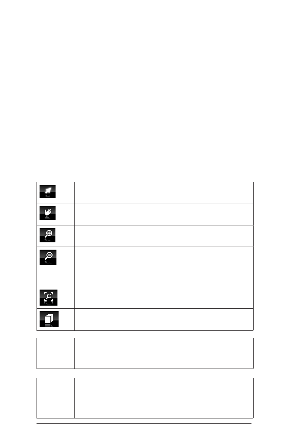
Mapping Tools
Mapping tools are in a bar above the tile bar. The
following tools are available:
Select: objects are selected to edit, delete, or
navigate to.
Pan: click and drag the map to view the
desired area.
Zoom In: using a stylus or finger draw a box
around the area of interest to zoom to it.
Zoom Out: using a stylus or finger draw a box
in which the current screen will fit. A large box
will zoom out a small amount, and a small box
will zoom out a long way.
Zoom to Project Extent: Click to zoom to the
combined extent of all the project layers.
Layers: toggle the layers you want to show on
and off.
Delete
Object
A mapped object can be deleted by
selecting the object and choosing the Delete
option from the context menu that appears.
Pause
and
Resume
While mapping a line or polygon, tap on
Stop to pause mapping. To resume, tap on
Capture to continue the mapping of the line
or polygon.