Spectra Precision MobileMapper Field & Office Software User Manual
Page 64
English
56
–
Click on
to quit the angle measurement tool.
• Deleting a Feature: Select a feature on the map screen
that you want to delete, and then click on the
Delete button
in the menu bar. Click
Yes to confirm that you want to
delete this feature.
• Adding base raw data from a file: This function is
convenient when the useful base raw data files have
already been downloaded from the Internet or if they come
from a reference station that is not connected to the
Internet. In either case, click on
Add Reference Raw
Data>From File and select the base raw data files.
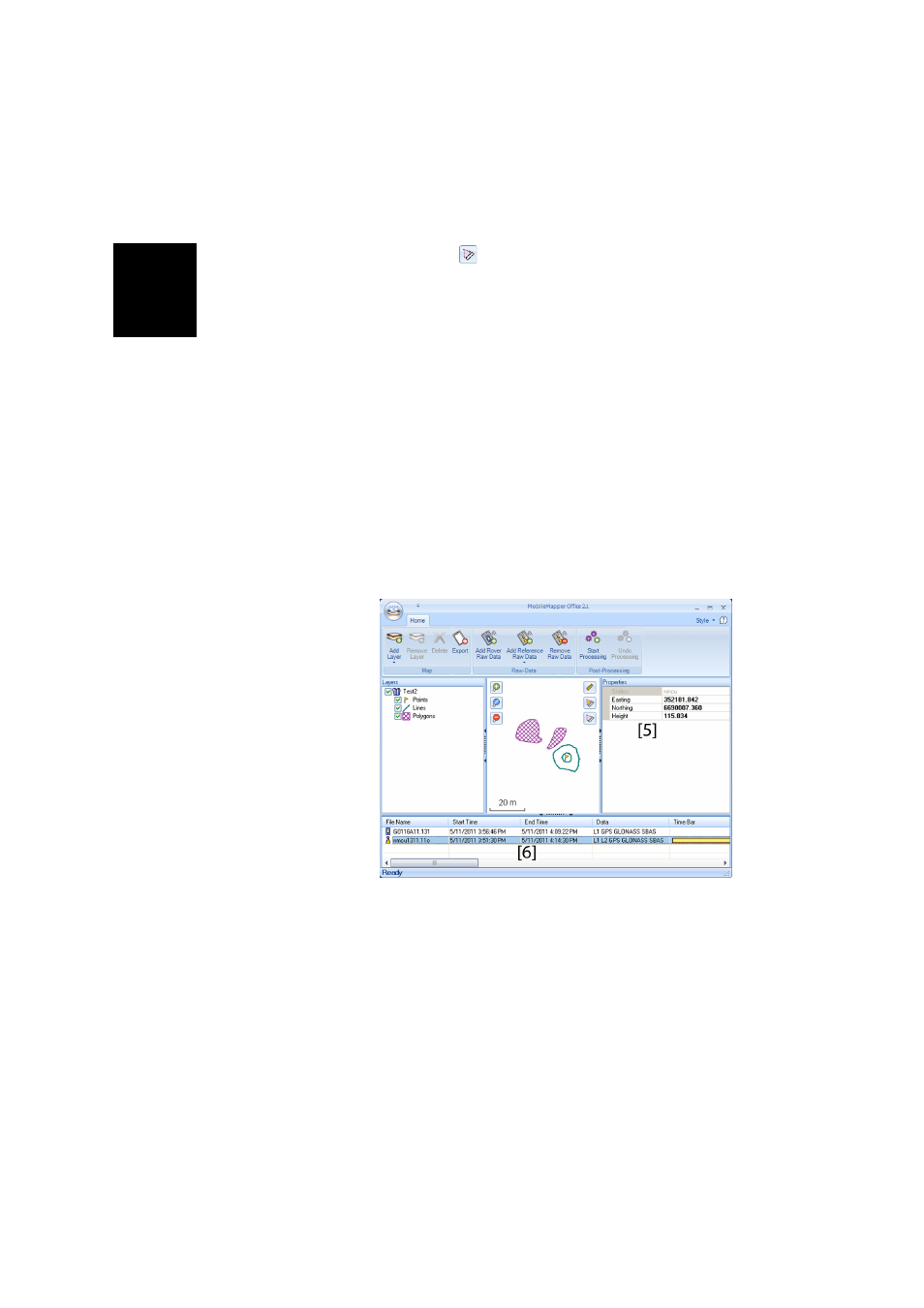
• Editing the Coordinates of the Base Station Used: You
may need to edit the coordinates of the base station before
starting the post-processing. As shown on the screen
below, just click in the row (in the lower panel ([6])
containing the base data file. You can then edit the base
coordinates in the right-hand panel ([5])
• Removing a layer from a map: Select the layer in area [3]
on the screen and press the Del key or click on
Remove
Layer.
•
Shortcuts: From Windows Explorer, double-clicking a map
file (*.map) will directly open the file in MobileMapper
Office. All the files that can potentially be layers in
MobileMapper Office can be dragged & dropped in the
open map file (equivalent to selecting
Add Layers>Select
Existing)