Defining a user system – Spectra Precision MobileMapper Field & Office Software User Manual
Page 47
Engl
ish
39
Defining a User
System
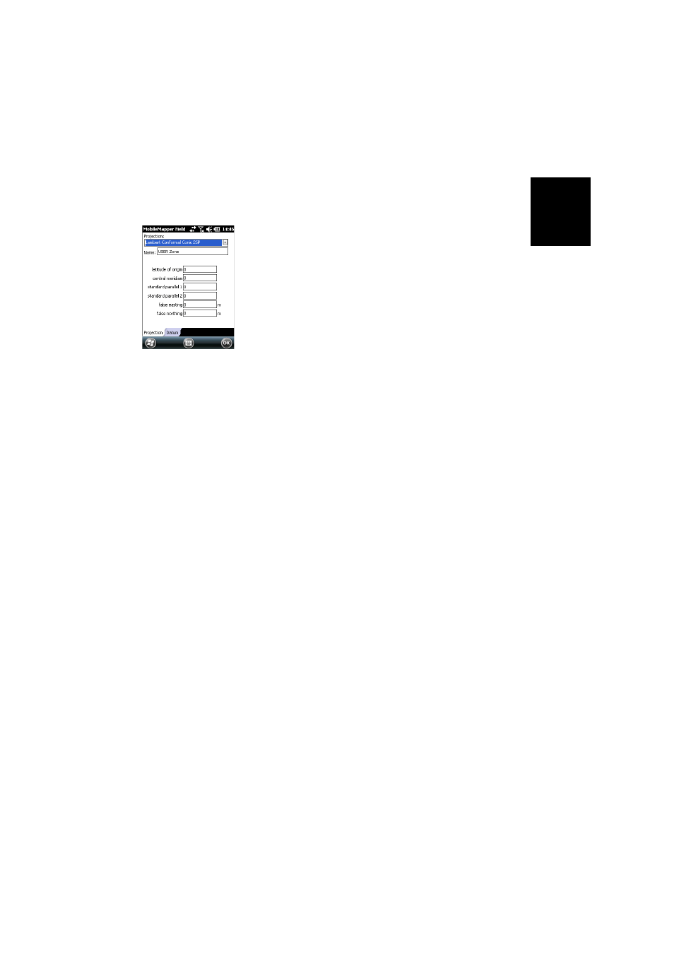
• Tap on the
New button.
• Select the type of projection you wish to use in your
coordinate system. Depending on that choice, you will
have to enter a certain number of parameters.
Remember every time you create a new projection and you
have to enter the latitude and longitude of origin, or the
central meridian, these must be expressed in degrees with
eight decimal places (ddd.dddddddd). On the other hand,
false eastings and false northings should always be
expressed in meters, even if a different unit has been
selected in the
Units field on the same screen.
• After you have named and defined your new projection
and datum, just tap
OK to save the new system and choose
it as the system used in the current job. This will take you
back to the coordinate system selection screen on which
you will now be able to see how the new USER coordinate
system has been defined (new projection and datum
names displayed in the second and third fields
respectively).
Viewing the
Properties of the
Coordinate System
Used in a Job
• Tap
Menu>Job>Properties.
• Tap on the
Coordinate System... tab. The screen now shows
the non-editable settings for the coordinate system used
in the map. Tap on the
Properties button to read the details
of the datum and projection used in the coordinate
system.