Logging new features, Introduction – Spectra Precision MobileMapper Field & Office Software User Manual
Page 32
English
24
Logging New Features
Introduction
For each new feature you log in the field, MobileMapper Field
allows you to set the following parameters, just before it
actually starts logging the feature:
• On the
Layer tab, you can choose:
– The name of the layer corresponding to the feature you
want to log (from the list of layers found in the job).
–
For MIF layers, and for those contained in a DXF job,
the geometry (i.e. point, line or polygon) of the feature.
This field is preset for CSV layers (points exclusively)
and for SHP layers.
• On the
Settings tab, you can set:
– The position averaging time at the end of which the
coordinates of a point feature will be logged. The
longer the averaging time, the better the precision you
get for each of your points. This implies staying still on
the point throughout the averaging time.
– The automatic or manual vertex logging mode for a line
or polygon feature:
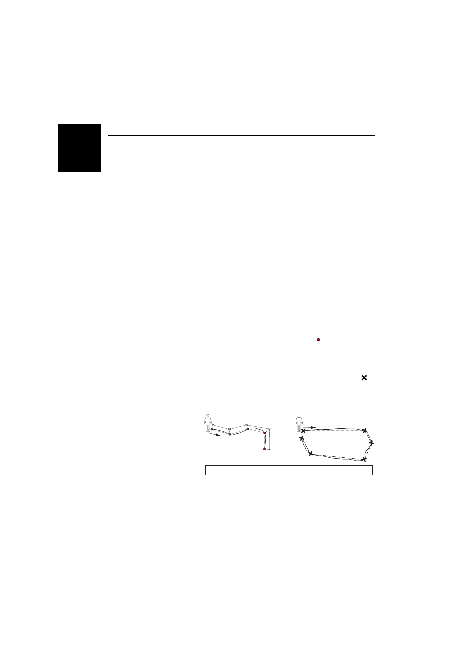
In
Automatic mode, the receiver automatically picks up
the position of each of the points (
) as you keep
walking along the feature. The logging rate i is preset
and represents either the time elapsed or the distance
traveled.
In
Manual mode, you stop at each of the vertices ( ),
on which the receiver computes a position averaged
over n seconds
Automatic
Manual
i
i
i
i
Continuous lines show actual paths traveled. Dotted lines show features, as logged.