Engl ish – Spectra Precision MobileMapper Field & Office Software User Manual
Page 37
Engl
ish
29
–
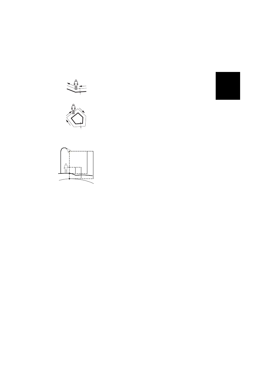
Direction: this parameter tells the program whether the
real feature is on your left or right.
–
Horizontal Distance field: Horizontal distance
perpendicular to the line or polygon feature.
If a range finder is used to measure this distance, tap
on the
Read Range Finder button once the range finder
has got a valid measurement. This will automatically
fill in the field.
If no range finder is used, type an estimate of the
horizontal distance directly in the field using the
keyboard. The better you estimate the distance, the
better the collected positions.
–
Vertical offset field: Height deviation from the physical
location of the feature to the ground, positive if above
the ground, negative otherwise (see illustration).
• Tap
OK. MobileMapper Field instantly starts logging the
feature.
If you have selected the automatic vertex mode, start
walking along the feature. You will then see a line being
drawn on the screen as you walk.
If you have selected the manual vertex mode, the receiver
will assume you are standing on the first vertex and so it
will log this vertex according to the chosen averaging time.
You will then have to walk to the next vertex and then
select
Menu>Resume to log the position of the second
vertex, etc.
• When you arrive at the end of the feature, tap
Menu and
select
Stop. MobileMapper Field then automatically
switches to the attribute list.
• Define each attribute for the line or polygon (see Entering
Values for Attributes on page 30).
NOTE: Like point features, you can enter the values of
attributes for a line or polygon not only at the end of the
feature logging sequence, but also at any time while
walking along the line or polygon. This can be done by
tapping on the
Attributes button located in the lower bar.
• Tap
OK to return to the map screen, which now shows the
location and shape of the feature according to the
representation defined in the layer properties.
NOTE: If some attributes are mandatory and you haven’t
set them yet when you tap
OK, MobileMapper Field will
first ask you to set them in their order of appearance in the
list of attributes before returning to the map screen.
Right
Left
d= Horizontal Distance
d
d
Coord S
ys
Ground
HA
HF
HG
VO
HF = HG - HA + VO
Where:
HF: Feature height expressed
on coordinate system used (computed)
HG: GNSS height (measured)
HA: Antenna Height above ground
(user set)
VO: Feature height above ground
(vertical offset, user-set)