Spectra Precision MobileMapper Field & Office Software User Manual
Page 55
Engl
ish
47
– [6]: Observation times covered by the raw data files
added to the project. A blue bar stands for a receiver
raw data file, and a yellow bar, for a base raw data file.
• Click
and select
Open. Browse to the folder
containing your field data files.
• Select the Map file and click
Open. MobileMapper Office
shows the content of the project in areas [3], [4] and [5]
(see screen above).
• Click on
Add Rover Raw Data. Select the raw data file
corresponding to the project (from the same folder as
previously) and click
Open. MobileMapper Office imports
the *G or GRW file and then shows the file properties in
areas [5] and [6].
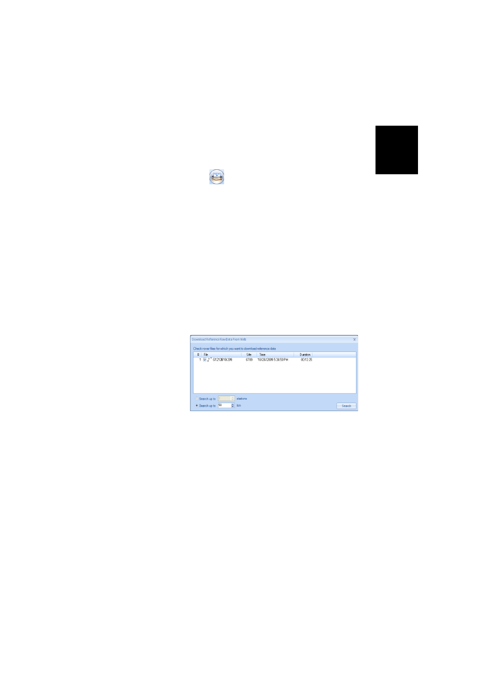
• Assuming you are working with a third-party reference
station, click successively on
Add Reference Raw Data then
From Web (your computer is supposed to have an Internet
connection). A new window then opens in which you have
to indicate how you wish to search for the reference
station you will use for post-processing your project.
• Choose one of the following two search criteria:
–
Search up to x stations: Specify a preset number of
stations you want to list before choosing one. All the
listed stations will be the closest to your working area,
but there is no range limit for these stations.
–
Search up to x km: Specify a limit of distance between
your working site and the stations. The shorter the
distance, the better the raw data from the station, but
the smaller the number of stations that can potentially
be used.