Garmin NavTalk Pilot User Manual
Page 96
82
Section 6
GPS Receiver
Reference
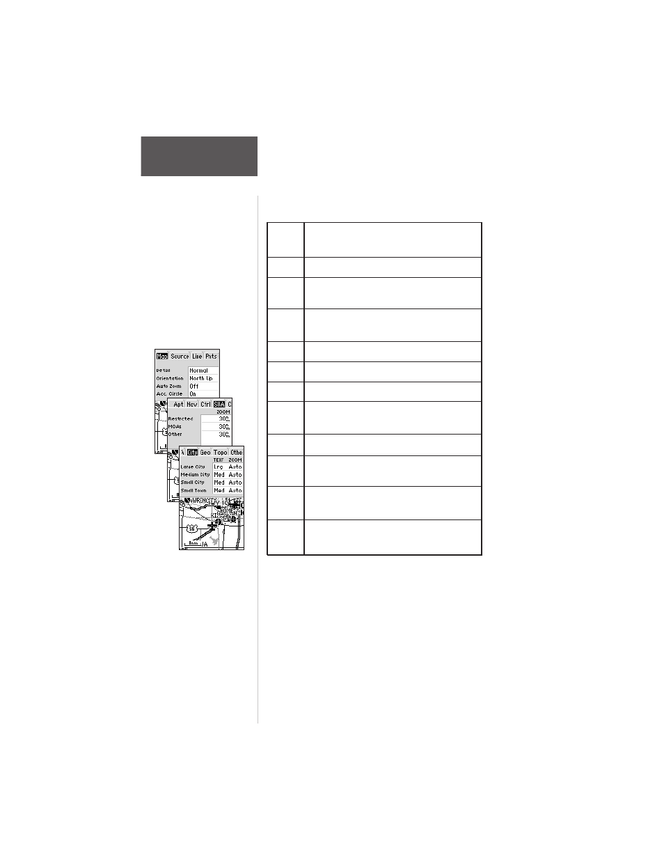
The map settings are organized
by a series of ‘file tabs’. Use the
ARROW keypad to select the
desired tab, and to select the
desired settings.
To change a map setup feature:
1. Highlight ‘Map Setup’ and press ENTER.
2. To change map orientation, select the ‘Map’ tab (if
not already selected) and press ENTER. Highlight
the ‘Orientation’ field and press ENTER. Select
‘North Up’ to fix the top of the map display to a
north heading. Select ‘Track Up’ to orient the top of
the map display to your current track. Select ‘DTK
Up’ to fix the top of the map display to your desired
course. Press ENTER to accept the selected option.
Map
Detail, Orientation, AutoZoom, Accuracy
Circle.
Source Basemap, Aviation Data, Mapsource
Line
Track Log, Active Route Lines, Local Roads,
Street Label Text
Points All Waypoints, Waypoint Text, Active Route
Wpts, Common Exits, Special Exits
Apt
Large/Medium/Small Airports and Text
Nav
VORs, NDBs, Intersections and Text
Ctrl
Controlled Airspace: Class B/C/D
SUA
Special-Use Airspace: Restricted, MOA,
Other
City
Large/Medium/Small Cities and Text
Geo
Geographical Points, Rivers, Lakes,
Park Areas
Topo
Topographical: Major/Medium/Minor
Contours, Land Coverage
Other Marine Navaids, Railroads, Metro
Areas, Lat/Lon
The following table lists the file tabs and available settings: