Garmin NavTalk Pilot User Manual
Page 87
73
Section 6
GPS Receiver
Reference
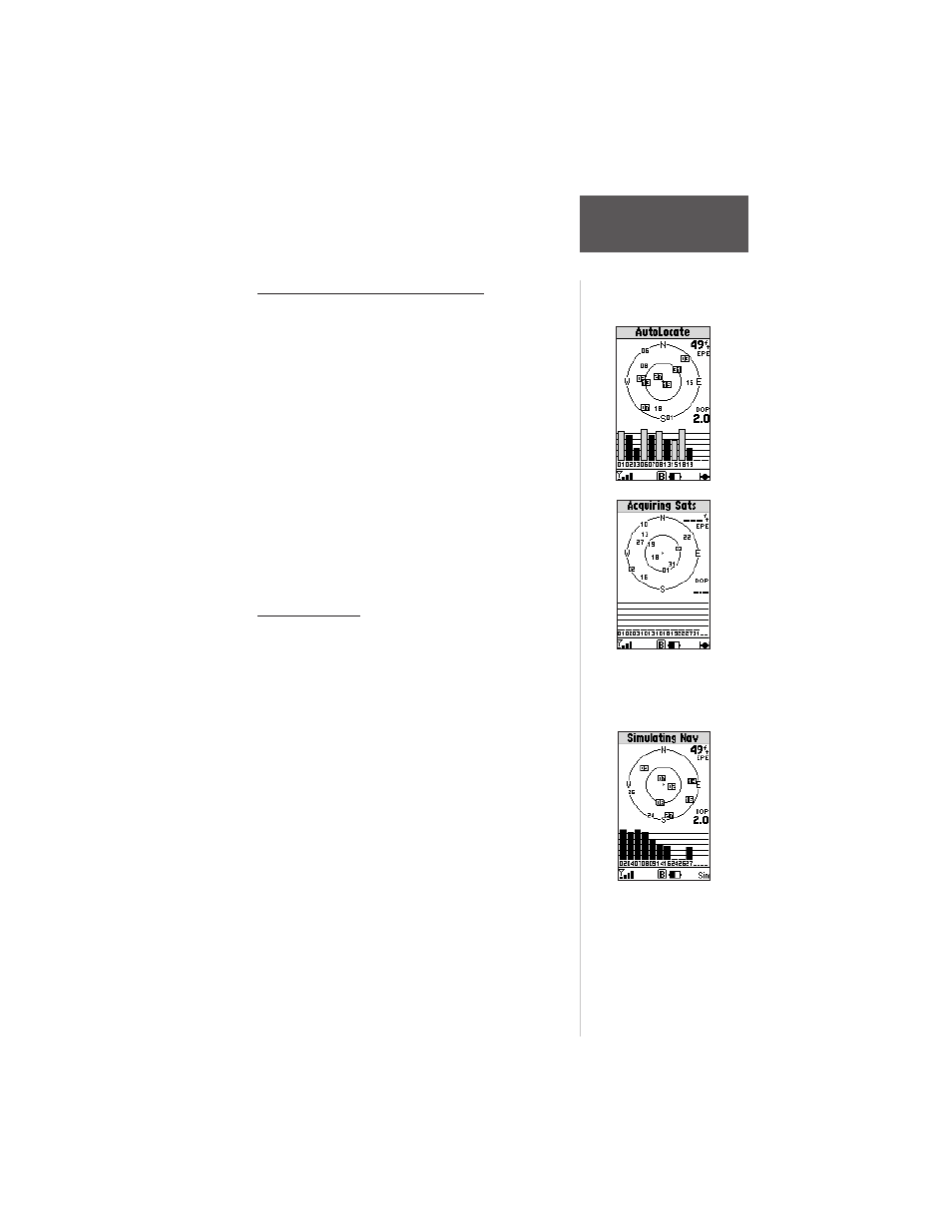
Sky View and Signal Strength Bars
The satellite sky view shows a bird’s-eye view of the
position of each available satellite relative to the unit’s last
known position. The outer circle represents the horizon
(north up); the inner circle 45º above the horizon and the
center point, directly overhead.
You can use the sky view to help determine if any
satellites are being blocked and whether you have a
current position fix, indicated by a ‘2D Navigation’ or ‘3D
Navigation’ in the status field. You can also set the sky
view to a ‘Track Up’ configuration, causing the top of the
sky view to align along your current track heading.
As soon as the unit has collected the necessary data to
calculate a fix, the status field will indicate a 2D or 3D
status. For ‘2D’, you may need to enter your altitude. See
pages 75 and 76.
Receiver Status
Receiver status is indicated at the top of the page. The
status will be shown as one of the following conditions:
Searching - the unit is looking for any available
satellites in view.
AutoLocate - the unit is initializing and collecting new
almanac data. This process can take up to 5 minutes,
depending on the satellites currently in view.
Acquiring - the receiver is collecting data from
available satellites, but has not collected enough
data to calculate a position fix.
2D Navigation - at least three satellites with good
geometry have been locked onto and a 2-dimen-
sional position fix (latitude and longitude) is being
calculated. ‘2D Diff’ will appear when you are
receiving DGPS corrections in 2D mode.
The unit is acquiring
satellite data to establish
a position fix.
Simulator On . “Sim’
appears on all Main
GPS and Cellular
Page status bars.