Garmin NavTalk Pilot User Manual
Page 90
76
Section 6
GPS Receiver
Reference
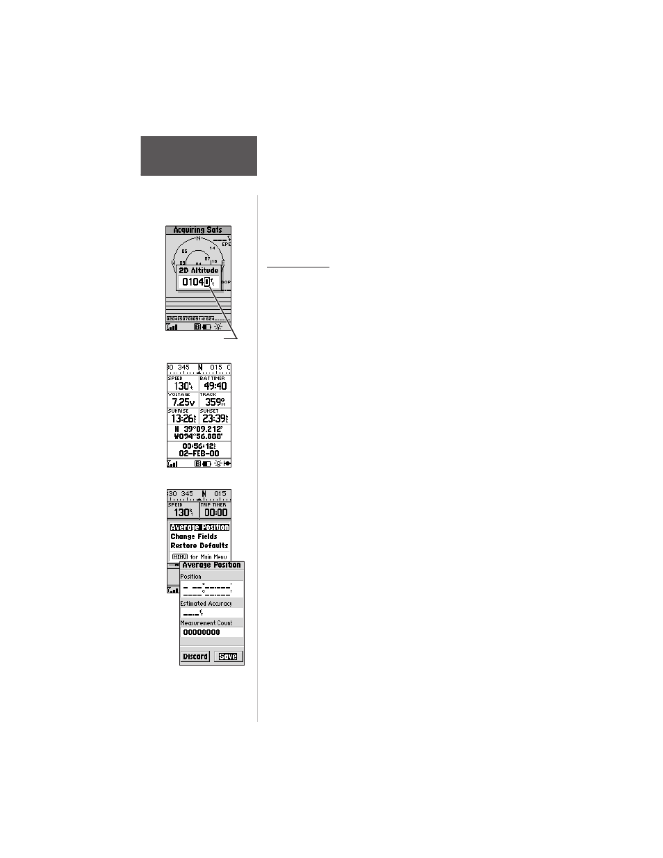
The Position Page
To enter an altitude:
1. Highlight ‘Set 2D Altitude’ and press ENTER.
2. Enter your approximate altitude using the ARROW
keypad, and press ENTER.
Position Page
The Position Page shows your location, what
direction you’re heading, and how fast you’re going plus a
multitude of optional data. It’s most useful when you are
traveling without an active destination waypoint.
The graphic heading display at the top of the page
indicates the direction you’re tracking, while you are
moving.
Directly below this display are the speed, average
speed, trip timer, trip odometer and sunrise/sunset fields
(default). The sunrise/sunset times indicated are for your
present position. These times, and the current time
display at the bottom of the page, can be displayed in
local or UTC (zulu) time. The lower left-hand corner of
the page shows your current latitude and longitude in
degrees and minutes (default).
The unit uses this basic information to mark exact
positions as waypoints. Average speed, sunrise and sunset
times also appear on the Position Page as default
selections. Units of measure and the position readout are
selectable from the Main Menu. ‘Trip Computer’
functions—such as average speed, max speed, trip
odometer and trip timer—can each be reset from the
Main Menu.
The following options are available:
Average Position - averages position samples over
time. Averaging reduces the effects of selective availability
on position error and results in a more accurate position
reading.
Set 2-D Altitude
“Pop-Up” Screen
Average Position Menu