Satdlitc status page, Searching – Garmin GPS 89 User Manual
Page 34
Attention! The text in this document has been recognized automatically. To view the original document, you can use the "Original mode".
Sutcllite in vt№
bal
not
curtcni^ in me (D3 &
17)
wiU be h|ghlighiei with «
Moeh reeton^e, anil will
show
a
contsponiling ■ finl-
low'sipial sirnigth kr
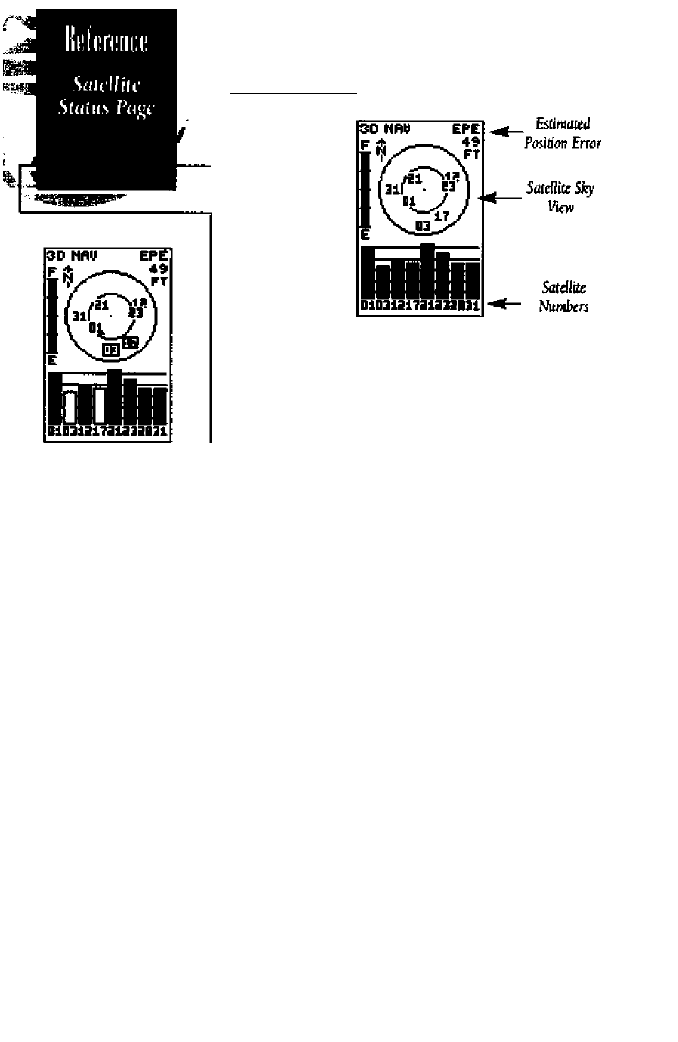
Satdlitc Status Page
Operfliing Mode
Baltery Level
Indicotor “
Signol Sirenglh
Indictttor Bars”
30
The satellite status page displai)^ the status of various
receiver functions. This status infonnation helps you under
stand what the GPS is doing at any given time, and tells you
whether or not the receiver has calculated a position fix.
The sky view and signal strength bats give you an indi
cation of what satellites ate visible to the receiver, whether or
not they are being used to calculate a position fix, and the
signal quality. The sky view in the center of the page shows
a bitd^-eye view of the position of each satellite relative to
the receiver’s last known position. The outer circle represents
the horiaon (north up); the inner circle 45“ above lie hori
zon; and the center point a position directly overhead.
When the receiver is looking for a particular satellite, the
corresponding signal strength bar wilt be blank and the sky
view indicator wdl be displayed as white numbers in a black
box. Once the receiver Im found the satellite, a hollow sig
nal strength bar will appear and indicate that the satellite l№
been found and the receiver is collecting data from it. The
satellite number in the sky view will also change to black
numbers with no box surrounding them. As soon as the GPS
89 has collected the necessary data to use the satellite for
positioning, the hollow bar will become solid.
Receiver status is indicated at the top left of the screen,
with the current horizontal accuracy (estimated position
error, in feet or meters) at the top right. The status field will
show one of the following conditions:
Searching—
the GPS 89 is looking for any available satel
lites in view.
AntoLncaie'^*’— the GPS 89 is initializing and collect
ing new almanac data. This may take 7.5 to 15 minutes.