960d, 28 mar 96, 25 apr 96 – Garmin GPS 89 User Manual
Page 13: Gps 89
Attention! The text in this document has been recognized automatically. To view the original document, you can use the "Original mode".
TaVcolfTottr
The GARMIN GPS 89 is a powerful navi^iion tool that
offers pilots a host of advanced features that help make (ly
ing safer and more efficient. The Takeoff Tour is designed to
quickly guide you through basic features and functions of the
GPS 89 using a simulated trip.
Once you’ve completed the tout and become familiar
with the main pages and features of the unit, refer to the ref
erence seaion for complete instructions on installation, ini
tialization and performing specific tadcs and functions.
The Takeoff Tout assumes you have initialized the receiv
er and have not changed any of the default settings for the
unit. If you have changed any settings, the descriptions and
pictures used may not match your configuration.
You’re now ready to power up and take off with the
world of GARMIN GPS!
1. Press and hold the D kevuntil the welcome page
appears.
2. After the unit performs a self-testr the database informa
tion page will appear, lisdng the issue date of the aviatkm
daQbese.
UORLDUIDE
CVCLE
960d
EFFECTIUE
28 MAR 96
TO
25 APR 96
The database page reflects the worldwide database of air
ports and VORh contained in the GPS 89. Database updates
and subscriptions are available from GARMIN and Jeppesen.
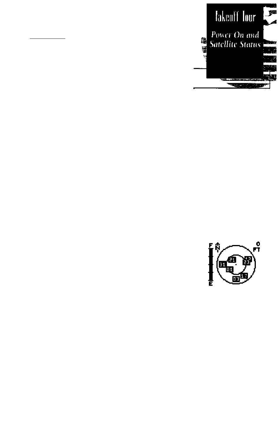
After a few seconds, the database information page will
be replaced with the satellite status page. The status page
provides a visual reference of satellite acquisition and status,
with signal strength bars and a satellite sky view in the cen
ter of the screen. The battery level gauge provides an indica
tion of remaining battery life and appears only when you are
connected to ejttemal power.
MELCOHE TO THE
GPS 89
SOFTUnRE 2.07
COPVRIOKT
1090
OARHtN CORP
WtUome Fafe
Tte
page
is displiiyed
as
tfie
CPS 89
conducts a sdj
test
scQuiRiHSTre
B1B3121TE1E3EE31
Status
Paft
Use
tlie simtis page to
instantly vjfiv satellUr
usage, current signal
stnngili, and haitcry level.