Comand, Navigation – Mercedes-Benz CL-Class 2013 Owners Manual User Manual
Page 174
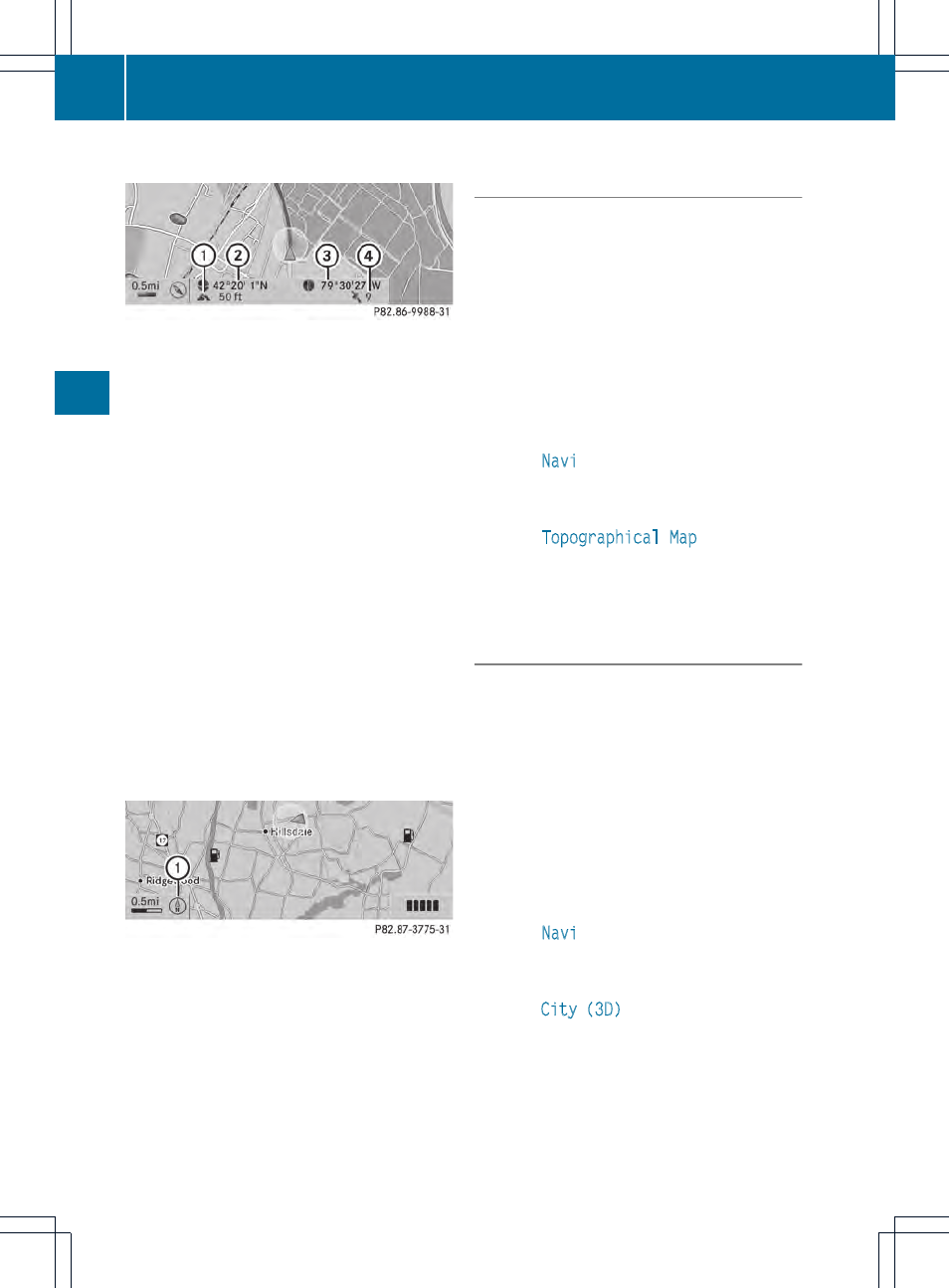
Geo-coordinate display
Geo-coordinate display active
:
Current height above average sea level,
rounded
;
Current vehicle position: latitude
coordinates
=
Current vehicle position: longitude
coordinates
?
Number of GPS satellites currently being
used
There must be sufficient GPS reception for all
displays to be shown. If this is not the case,
the display will be grayed out. Height
display : may vary from the actual value,
because the navigation system uses the GPS
signals for the calculation.
While scrolling the map (
Y
page 169), you will
see the geo-coordinates of the crosshair
position. Height display : and number of
satellites used ? are not displayed.
"None" menu option
Display switched off
:
Current map orientation
i
During the "Move map" function you can
see additional information depending on
the position of the crosshair, such as a road
name, if the digital map supports this data.
Switching the topographical map on/
off
The topographical map uses different colors
to depict elevation. The color key generally
reflects the topography's dominant
vegetation or the ground's perceived color
when seen from the air, for example:
R
green for lowland
R
yellow or brown for hills
R
gray or white for mountains
X
To show the menu: press W the COMAND
controller.
X
Select
Navi
in the main function bar by
sliding ZV and turning cVd the COMAND
controller and press W to confirm.
X
Select
Topographical Map
and confirm
with W.
Depending on the previous state, switch
the option on O or off ª.
Switching the city model on/off
When the city model is switched on, the map
shows buildings as 3D models.
i
The city model is only shown in the "3D
map" map orientation.
It is available for map scales 50 m and
100 m.
The data required for displaying buildings
is not available for all cities.
X
To show the menu: press W the COMAND
controller.
X
Select
Navi
in the main function bar by
sliding ZV and turning cVd the COMAND
controller and press W to confirm.
X
Select
City (3D)
and press W to confirm.
Depending on the previous state, switch
the option on O or off ª.
172
Navigation
COMAND