Moving the map to the location you want to see – Pioneer CNDV-50MT User Manual
Page 22
20
Ch
ap
te
r
1
Ba
sic
Op
er
at
ion
within a range of 25 metres - 500 kilometres (25
yards - 250 miles).
❒
The icon of a registered location and traffic
information icon are indicated when the map
scale is 20 km (10 miles) or lower.
❒
POI icon and the traffic jam line are indicated
when the map scale is 1 km (0.75 miles) or
lower.
❒
The Direct scale key may not appear
depending on the map display mode.
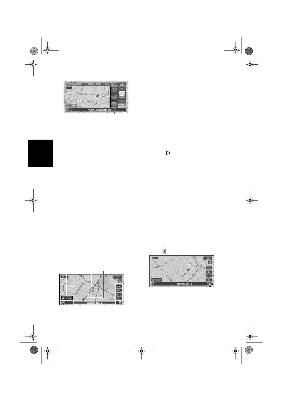
Moving the map to the location
you want to see
If you touch the map of your surroundings (Side
map) briefly, the shortcut menu appears.
Touching anywhere on the map for at least 2
seconds changes the map to Scroll mode and the
map begins scrolling in the direction you
touched. The scrolling stops when you release
your finger from the screen. At this time, the
scroll cursor appears at the centre of the screen.
Also a line connecting between the current
location and scroll cursor appears.
Pressing the NAVI (or POS) button returns you
to the map of your surroundings.
❒
Touch the area close to the centre of the
screen to scroll slowly; touch near the sides of
the screen to scroll through quickly.
(1) Scroll location
The position of scroll cursor shows the location
selected on the current map.
❒
In the vicinity of the scroll cursor the road
appears light blue.(The case of a map scale of
200 m (0.25 mile) or lower.)
(2) Direction line
The direction towards the scroll cursor is
indicated with a straight line.
(3) Distance from the current location
Shows the distance in a straight line between the
location indicated by the scroll cursor and your
current location.
(4) The street name, city name, area name
and other information for this place.
Touching the
on the right displays hidden text.
➲
Displaying information on the specified
location ➞ Page 20
❒
According to the map scale, items displayed
on the map may differ.
(5) Shortcut menu
➲
How to view shortcut menu ➞ Page 16
Viewing the information of a specified
location
An icon appears at registered places (home
location, specific places, address book entries)
and places where there is a POI icon or traffic
information icon. Place the scroll cursor over the
icon to view detailed information.
1
Scroll the map and move the cross pointer
to the icon you want to view.
2
Touch .
Information for a specified location appears.
The information shown varies according to
the location. (There may be no information for
that location.)
➲
Registering places ➞ Page 35
➲
Displaying facilities (POI) mark on the map
➞
Page 32
Direct scale key
(4)
(5)
(1)
(3)
(2)
MAN-CNDV-50MTP-EN.book Page 20 Friday, April 29, 2005 10:33 AM