Appendix e terrain avoidance colors and symbols – Garmin G1000 Mooney M20TN User Manual
Page 515
190-00647-02 Rev. A
Garmin G1000 Pilot’s Guide for the Mooney M20M/M20R/M20TN
SY
STEM
O
VER
VIEW
FLIGHT
INSTRUMENTS
EIS
AUDIO P
ANEL
& CNS
FLIGHT
MANA
GEMENT
HAZARD
AV
OID
ANCE
AFCS
ADDITIONAL
FEA
TURES
APPENDICES
INDEX
501
APPENDIX E
TERRAIN AVOIDANCE COLORS AND SYMBOLS
*МiМ>Ê«>VМК*М
1} Мi`К"LГМ>Vi
*ÀiVÌi`К} МК*>Ì
£äääÊvÌÊ
£ääÊvÌÊ/ АiГ `К
/iАА>ÊLÛiÊÀVÀ>vМКММХ`iК
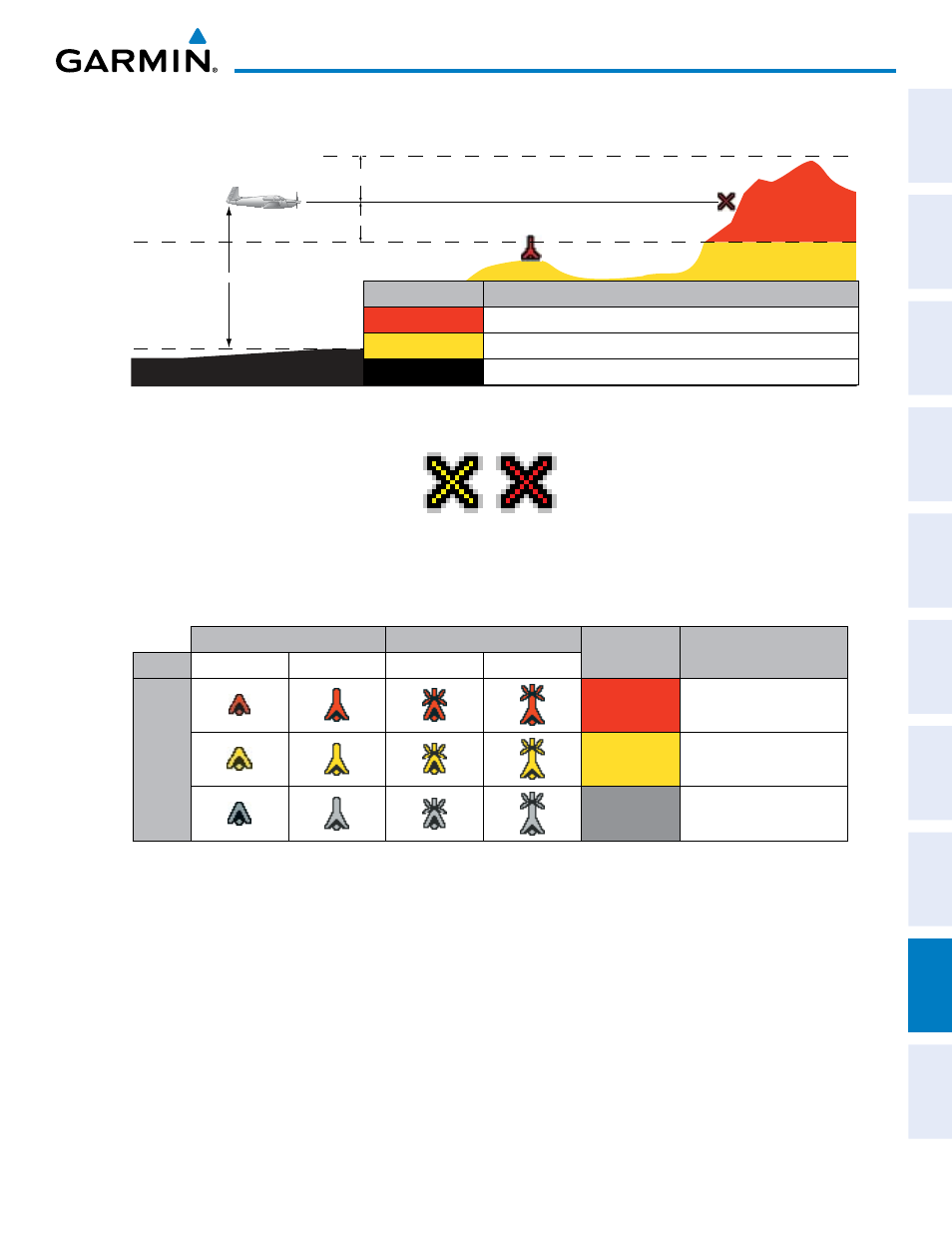
Terrain Color
Terrain Location
Red (WARNING) Terrain above, or within 100 ft below the aircraft altitude
Yellow (CAUTION) Terrain between 100 ft and 1000 ft below the aircraft altitude
Black
Terrain more than 1000 ft below the aircraft altitude
Figure E-1 TAWS Color Chart
Figure E-2 TAWS Potential Impact Points
Unlighted Obstacle
Lighted Obstacle
Obstacle
Color
Obstacle Location
Height < 1000 ft AGL > 1000 ft AGL < 1000 ft AGL > 1000 ft AGL
Obstacle Symbol
Red
(WARNING)
Obstacle within 100 ft of
or above aircraft altitude
Yellow
(CAUTION)
Obstacle within 1000 ft of
aircraft altitude
Gray
Obstacle more than 1000
ft below aircraft altitude
Obstacle Symbols and Colors