Flight management – Garmin G1000 Mooney M20TN User Manual
Page 158
Garmin G1000 Pilot’s Guide for the Mooney M20M/M20R/M20TN
190-00647-02 Rev. A
144
FLIGHT MANAGEMENT
SY
STEM
O
VER
VIEW
FLIGHT
INSTRUMENTS
EIS
AUDIO P
ANEL
& CNS
FLIGHT
MANA
GEMENT
HAZARD
AV
OID
ANCE
AFCS
ADDITIONAL FEA
TURES
APPENDICES
INDEX
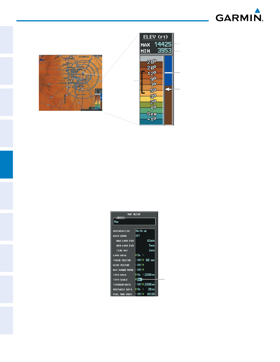
Figure 5-16 Navigation Map - TOPO SCALE
Maximum Displayed Elevation
Minimum Displayed Elevation
Aircraft Altitude (MSL)
Ground Elevation at Map
Pointer Location (only
visible when Map Pointer is
displayed)
Range of
Displayed
Elevations
Displaying/removing the topographic scale (TOPO SCALE):
1)
Press the MENU Key with the Navigation Map Page displayed. The cursor flashes on the ‘Map Setup’ option.
2)
Press the ENT Key. The Map Setup Menu is displayed.
3)
Select the ‘Map’ group and press the ENT Key.
4)
Highlight the ‘TOPO SCALE’ field.
5)
Select ‘On’ or ‘Off’.
6)
Press the FMS Knob to return to the Navigation Map Page.
Figure 5-17 Navigation Map Setup Menu - TOPO SCALE Setup
TOPO SCALE
On/Off