Raymarine Marine GPS System User Manual
Page 89
Working With Charts And Routes
4-25
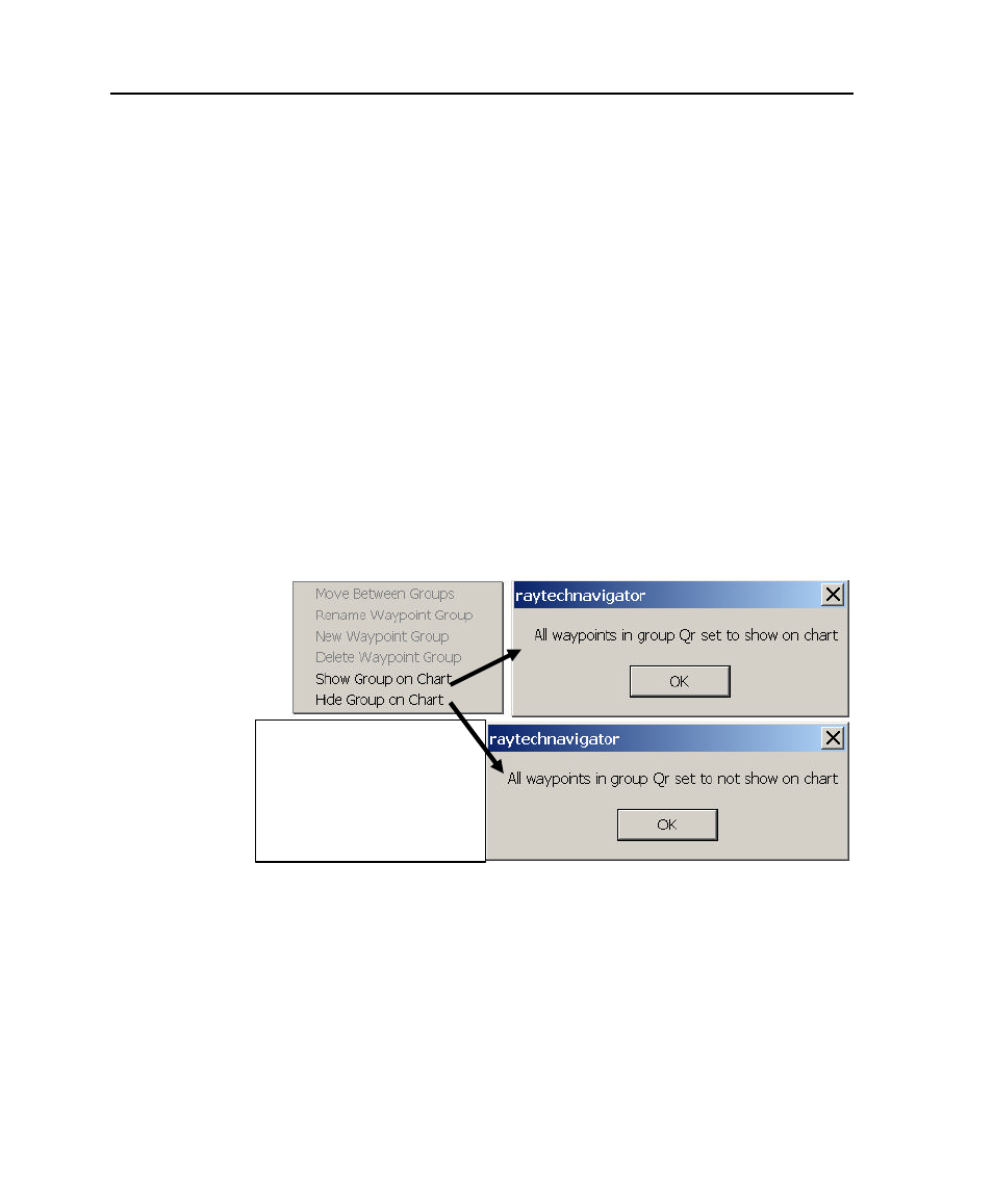
To display or hide a waypoint group:
1. Double-click on a waypoint (or select
Edit Route
from
the Route menu, then click
Waypoint Properties
) to
display the Waypoint Properties dialog box (Figure 4-20).
2. Click the
Group Name
drop-down menu, then select the
group you want to delete.
3. Click
Groups
to display the Group Action popup menu.
4. Select
Show Group on Chart
to display the waypoints, or
Hide Group on Chart
to remove them. A confirmation
dialog appears (Figure 4-24).
5. Click
OK
to show or hide the waypoints.
Figure 4-24. Showing or Hiding a Waypoint Group
Click
Groups
on Waypoint
Properties dialog to display
Group Action popup, then
select
Show Group on Chart
or
Show Group on Chart
to
display or hide the waypoints
- RAYTHEON E32001 (13 pages)
- RAYCHART 420 (101 pages)
- L365 (83 pages)
- SR50 (48 pages)
- A65 (100 pages)
- RS12 (50 pages)
- DSM300 (82 pages)
- NMEA Multiplexer (16 pages)
- Pathfinder (111 pages)
- Pathfinder Radar (244 pages)
- autopilot control unit (111 pages)
- VolvoPenta IPS Autopilot System DPU (16 pages)
- autopilot + ST4000+ (145 pages)
- stand-alone master instrument (45 pages)
- ST80 (15 pages)
- Raystar 125 (8 pages)
- RS12 (38 pages)
- ST6001 (48 pages)
- Pathfinder Radar Scanners (66 pages)
- Chartplotter (101 pages)
- Heading Sensor (24 pages)
- Ray430 (54 pages)
- Viewable Marine Displays (38 pages)
- C Series (244 pages)
- ST8001 (48 pages)
- hsb2 PLUS Series (246 pages)
- 631 PLUS (170 pages)
- navigation system (17 pages)
- ST8002 (48 pages)
- PowerPilot (18 pages)
- ST7002 (52 pages)
- GPS Kit (24 pages)
- 465 (107 pages)
- Ray54E (116 pages)
- GPS Plotter (131 pages)
- GPS navigation (75 pages)
- ST7001 (48 pages)
- 300 (136 pages)
- Raystar 120 (30 pages)
- autopilot (137 pages)
- DSM30 (34 pages)
- Platinum Chart Card (29 pages)
- ST6002 (56 pages)
- 320 (139 pages)